

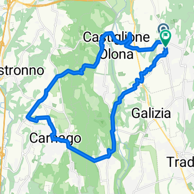
Gita MTB 2022 Colle San Maffeo
A cycling route starting in Venegono Superiore, Lombardy, Italy.
Overview
About this route
- -:--
- Duration
- 43.3 km
- Distance
- 667 m
- Ascent
- 672 m
- Descent
- ---
- Avg. speed
- 488 m
- Max. altitude

Route quality
Waytypes & surfaces along the route
Waytypes
Track
18.6 km
(43 %)
Quiet road
10 km
(23 %)
Surfaces
Paved
7.8 km
(18 %)
Unpaved
19.5 km
(45 %)
Ground
15.2 km
(35 %)
Asphalt
7.8 km
(18 %)
Continue with Bikemap
Use, edit, or download this cycling route
You would like to ride Gita MTB 2022 Colle San Maffeo or customize it for your own trip? Here is what you can do with this Bikemap route:
Free features
- Save this route as favorite or in collections
- Copy & plan your own version of this route
- Sync your route with Garmin or Wahoo
Premium features
Free trial for 3 days, or one-time payment. More about Bikemap Premium.
- Navigate this route on iOS & Android
- Export a GPX / KML file of this route
- Create your custom printout (try it for free)
- Download this route for offline navigation
Discover more Premium features.
Get Bikemap PremiumFrom our community
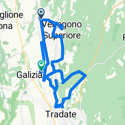
Other popular routes starting in Venegono Superiore
 Blistering ride in Venegono Superiore
- Distance
- 34.4 km
- Ascent
- 274 m
- Descent
- 276 m
- Location
- Venegono Superiore, Lombardy, Italy
 Da Via Solferino 8, Venegono Superiore a Via San Martino 1, Venegono Superiore
- Distance
- 26.6 km
- Ascent
- 250 m
- Descent
- 252 m
- Location
- Venegono Superiore, Lombardy, Italy
 venegono-visevar
- Distance
- 19.6 km
- Ascent
- 271 m
- Descent
- 325 m
- Location
- Venegono Superiore, Lombardy, Italy
 Da Via Nazario Sauro a Via Nazario Sauro
- Distance
- 20.4 km
- Ascent
- 298 m
- Descent
- 300 m
- Location
- Venegono Superiore, Lombardy, Italy
 Percorso rilassato in Venegono Superiore
- Distance
- 31.2 km
- Ascent
- 383 m
- Descent
- 342 m
- Location
- Venegono Superiore, Lombardy, Italy
 Da Via Nazario Sauro a Via D. Chiesa 13/B
- Distance
- 21.1 km
- Ascent
- 199 m
- Descent
- 265 m
- Location
- Venegono Superiore, Lombardy, Italy
 Via Galileo Galilei 7, Venegono Superiore to Via dell'industria 16, Venegono Inferiore
- Distance
- 15 km
- Ascent
- 122 m
- Descent
- 247 m
- Location
- Venegono Superiore, Lombardy, Italy
 Gita MTB 2022 Colle San Maffeo
- Distance
- 43.3 km
- Ascent
- 667 m
- Descent
- 672 m
- Location
- Venegono Superiore, Lombardy, Italy
Open it in the app