

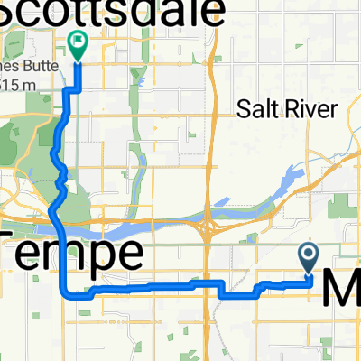
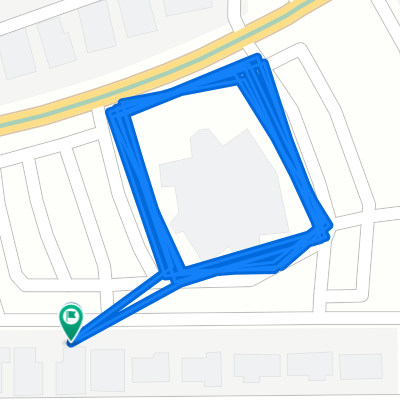
73km Uptown Market
A cycling route starting in Mesa, Arizona, United States.
Overview
About this route
- -:--
- Duration
- 73.4 km
- Distance
- 67 m
- Ascent
- 65 m
- Descent
- ---
- Avg. speed
- 385 m
- Max. altitude

Route quality
Waytypes & surfaces along the route
Waytypes
Cycleway
38.1 km
(52 %)
Pedestrian area
11 km
(15 %)
Surfaces
Paved
63.1 km
(86 %)
Unpaved
6.6 km
(9 %)
Asphalt
33 km
(45 %)
Concrete
29.3 km
(40 %)
Continue with Bikemap
Use, edit, or download this cycling route
You would like to ride 73km Uptown Market or customize it for your own trip? Here is what you can do with this Bikemap route:
Free features
- Save this route as favorite or in collections
- Copy & plan your own version of this route
- Sync your route with Garmin or Wahoo
Premium features
Free trial for 3 days, or one-time payment. More about Bikemap Premium.
- Navigate this route on iOS & Android
- Export a GPX / KML file of this route
- Create your custom printout (try it for free)
- Download this route for offline navigation
Discover more Premium features.
Get Bikemap PremiumFrom our community
Other popular routes starting in Mesa
 Relaxed route in Mesa
- Distance
- 39 km
- Ascent
- 810 m
- Descent
- 812 m
- Location
- Mesa, Arizona, United States
 Paragon to Rio Verde
- Distance
- 90.8 km
- Ascent
- 370 m
- Descent
- 370 m
- Location
- Mesa, Arizona, United States
 East Jaeger Street 2235, Mesa to East Jaeger Street 2235, Mesa
- Distance
- 31.5 km
- Ascent
- 40 m
- Descent
- 19 m
- Location
- Mesa, Arizona, United States
 canal-pecans-Lindsey-brown-power-Alma school
- Distance
- 70.2 km
- Ascent
- 90 m
- Descent
- 89 m
- Location
- Mesa, Arizona, United States
 Spook Mtn 20
- Distance
- 32 km
- Ascent
- 191 m
- Descent
- 189 m
- Location
- Mesa, Arizona, United States
 Steady ride in Tempe
- Distance
- 15.9 km
- Ascent
- 38 m
- Descent
- 64 m
- Location
- Mesa, Arizona, United States
 Home - Echo Coffee
- Distance
- 17.4 km
- Ascent
- 46 m
- Descent
- 39 m
- Location
- Mesa, Arizona, United States
 Peter
Peter- Distance
- 2 km
- Ascent
- 0 m
- Descent
- 0 m
- Location
- Mesa, Arizona, United States
Open it in the app