

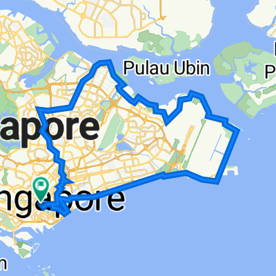
NINTENDO ISLAND TOUR - AMENDED 2
A cycling route starting in Singapore, Central Singapore Community Development Council, Singapore.
Overview
About this route
- -:--
- Duration
- 75.3 km
- Distance
- 129 m
- Ascent
- 135 m
- Descent
- ---
- Avg. speed
- 26 m
- Max. altitude

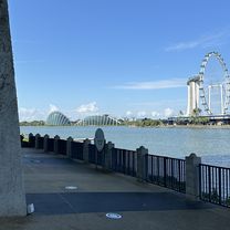
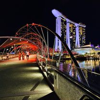
Route highlights
Points of interest along the route
Point of interest after 36.1 km
Continue with Bikemap
Use, edit, or download this cycling route
You would like to ride NINTENDO ISLAND TOUR - AMENDED 2 or customize it for your own trip? Here is what you can do with this Bikemap route:
Free features
- Save this route as favorite or in collections
- Copy & plan your own version of this route
- Sync your route with Garmin or Wahoo
Premium features
Free trial for 3 days, or one-time payment. More about Bikemap Premium.
- Navigate this route on iOS & Android
- Export a GPX / KML file of this route
- Create your custom printout (try it for free)
- Download this route for offline navigation
Discover more Premium features.
Get Bikemap PremiumFrom our community
Other popular routes starting in Singapore
 Punggol East, Singapore to Kallang, Singapore
- Distance
- 49.6 km
- Ascent
- 125 m
- Descent
- 130 m
- Location
- Singapore, Central Singapore Community Development Council, Singapore
 Punggol Rd, Singapore to Helix Bridge, Singapore
- Distance
- 17.8 km
- Ascent
- 245 m
- Descent
- 251 m
- Location
- Singapore, Central Singapore Community Development Council, Singapore
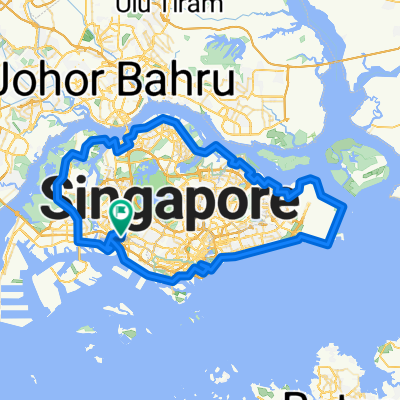
 Round the Island
- Distance
- 130.5 km
- Ascent
- 171 m
- Descent
- 174 m
- Location
- Singapore, Central Singapore Community Development Council, Singapore
 159308 Dinner to Sentosa
- Distance
- 18.7 km
- Ascent
- 317 m
- Descent
- 337 m
- Location
- Singapore, Central Singapore Community Development Council, Singapore
 Round Island (126km)
- Distance
- 126 km
- Ascent
- 190 m
- Descent
- 190 m
- Location
- Singapore, Central Singapore Community Development Council, Singapore
 NINTENDO ISLAND TOUR - AMENDED 2
- Distance
- 75.3 km
- Ascent
- 129 m
- Descent
- 135 m
- Location
- Singapore, Central Singapore Community Development Council, Singapore
 High Street - Kallang - PotongPasir - Bishan - YCK - Punggol - Pasir Ris - TMCR - ECP - Reservoir - High street
- Distance
- 78.6 km
- Ascent
- 487 m
- Descent
- 487 m
- Location
- Singapore, Central Singapore Community Development Council, Singapore
 Singapore PCN Cycle Loop
- Distance
- 143.4 km
- Ascent
- 556 m
- Descent
- 538 m
- Location
- Singapore, Central Singapore Community Development Council, Singapore
Open it in the app