Fahrradtour Klasse 4b mit Pausen Stationen
- 12.2 km
- 74 m
- 82 m
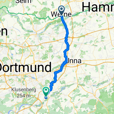
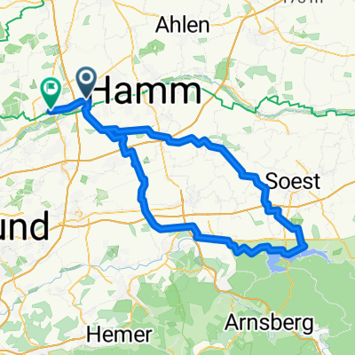
- Werne, North Rhine-Westphalia, Germany
RSC Werne WWBT 2022
A cycling route starting in Werne, North Rhine-Westphalia, Germany.
Overview
created this 4 years ago
Part of
3 stages
Route quality
Track
13 km
(35 %)
Quiet road
11.9 km
(32 %)
Paved
19.3 km
(52 %)
Unpaved
15.6 km
(42 %)
Asphalt
17.4 km
(47 %)
Gravel
10 km
(27 %)
Continue with Bikemap
You would like to ride WWBT 2022 Variante 37 km 03.11.2021 or customize it for your own trip? Here is what you can do with this Bikemap route:
Free trial for 3 days, or one-time payment. More about Bikemap Premium.
Discover more Premium features.
Get Bikemap PremiumFrom our community
Open it in the app