

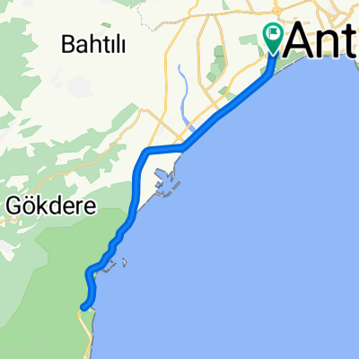
Hurma mah, Konyaaltı - Duden Waterfall
A cycling route starting in Konyaalti, Antalya Province, Republic of Türkiye.
Overview
About this route
- 3 h 20 min
- Duration
- 43 km
- Distance
- 498 m
- Ascent
- 500 m
- Descent
- 12.9 km/h
- Avg. speed
- ---
- Max. altitude

Route photos


Continue with Bikemap
Use, edit, or download this cycling route
You would like to ride Hurma mah, Konyaaltı - Duden Waterfall or customize it for your own trip? Here is what you can do with this Bikemap route:
Free features
- Save this route as favorite or in collections
- Copy & plan your own version of this route
- Sync your route with Garmin or Wahoo
Premium features
Free trial for 3 days, or one-time payment. More about Bikemap Premium.
- Navigate this route on iOS & Android
- Export a GPX / KML file of this route
- Create your custom printout (try it for free)
- Download this route for offline navigation
Discover more Premium features.
Get Bikemap PremiumFrom our community
Other popular routes starting in Konyaalti
 249. Sokak 2, Konyaaltı to Likya Yolu, Konyaaltı
- Distance
- 16 km
- Ascent
- 448 m
- Descent
- 66 m
- Location
- Konyaalti, Antalya Province, Republic of Türkiye
 Antalya Route to Saklikent and back
- Distance
- 73.9 km
- Ascent
- 1,567 m
- Descent
- 1,567 m
- Location
- Konyaalti, Antalya Province, Republic of Türkiye
 Hurma Mah, Konyaaltı - Salıncak Gözlem evi restoran
- Distance
- 13.2 km
- Ascent
- 555 m
- Descent
- 47 m
- Location
- Konyaalti, Antalya Province, Republic of Türkiye
 Zaterdag rondje
- Distance
- 64.7 km
- Ascent
- 1,288 m
- Descent
- 1,286 m
- Location
- Konyaalti, Antalya Province, Republic of Türkiye
 213. Sokak 9, Konyaaltı to 4090. Sokak 24, Konyaaltı
- Distance
- 24.1 km
- Ascent
- 940 m
- Descent
- 0 m
- Location
- Konyaalti, Antalya Province, Republic of Türkiye
 Hurma mah, Konyaaltı - Duden Waterfall
- Distance
- 43 km
- Ascent
- 498 m
- Descent
- 500 m
- Location
- Konyaalti, Antalya Province, Republic of Türkiye
 От 13. Sokak 9, Bahtılı Köyü Köyü до Konyaaltı Hisarçandır Yolu
- Distance
- 4.6 km
- Ascent
- 208 m
- Descent
- 86 m
- Location
- Konyaalti, Antalya Province, Republic of Türkiye
 antalya yarı mesafe
- Distance
- 31.1 km
- Ascent
- 234 m
- Descent
- 236 m
- Location
- Konyaalti, Antalya Province, Republic of Türkiye
Open it in the app