

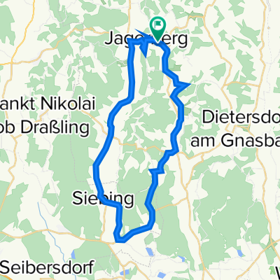
FB14 Tälertour im Thermen- und Vulkanland Steiermark
A cycling route starting in Jagerberg, Styria, Austria.
Overview
About this route
Up and down through the volcanic land. FB 14 Tälertour is one of 14 forest and meadow tours in the Feldbach region in the thermal and volcanic land of Styria.
- -:--
- Duration
- 31.5 km
- Distance
- 688 m
- Ascent
- 687 m
- Descent
- ---
- Avg. speed
- 427 m
- Max. altitude
Route quality
Waytypes & surfaces along the route
Waytypes
Quiet road
23.6 km
(75 %)
Road
5.4 km
(17 %)
Undefined
2.5 km
(8 %)
Surfaces
Paved
31.5 km
(100 %)
Asphalt
31.5 km
(100 %)
Continue with Bikemap
Use, edit, or download this cycling route
You would like to ride FB14 Tälertour im Thermen- und Vulkanland Steiermark or customize it for your own trip? Here is what you can do with this Bikemap route:
Free features
- Save this route as favorite or in collections
- Copy & plan your own version of this route
- Sync your route with Garmin or Wahoo
Premium features
Free trial for 3 days, or one-time payment. More about Bikemap Premium.
- Navigate this route on iOS & Android
- Export a GPX / KML file of this route
- Create your custom printout (try it for free)
- Download this route for offline navigation
Discover more Premium features.
Get Bikemap PremiumFrom our community
Other popular routes starting in Jagerberg
 FB14 Tälertour im Thermen- und Vulkanland Steiermark
- Distance
- 31.5 km
- Ascent
- 688 m
- Descent
- 687 m
- Location
- Jagerberg, Styria, Austria
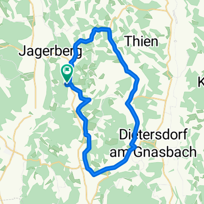
 Jagerberg-Kirchbach-Kirchberg-Feldbach-Hof-Jagerberg
- Distance
- 82.4 km
- Ascent
- 622 m
- Descent
- 622 m
- Location
- Jagerberg, Styria, Austria
 Jagerberg 141, Jagerberg nach Jagerberg 141, Jagerberg
- Distance
- 30.7 km
- Ascent
- 279 m
- Descent
- 279 m
- Location
- Jagerberg, Styria, Austria
 Große Hauptstraßen-Runde Jagerberg - Mettersdorf - Weinburg - St. Peter - Jagerberg
- Distance
- 38.8 km
- Ascent
- 331 m
- Descent
- 333 m
- Location
- Jagerberg, Styria, Austria
 Unterzirknitz-Unterauersbach-Bierbaum-St.Peter-Unterzirknitz
- Distance
- 22.1 km
- Ascent
- 168 m
- Descent
- 168 m
- Location
- Jagerberg, Styria, Austria
 kurze Hügelrunde
- Distance
- 15.6 km
- Ascent
- 279 m
- Descent
- 279 m
- Location
- Jagerberg, Styria, Austria
 Kleine Runde ab Jagerberg - Asphalt und Schotter
- Distance
- 13.6 km
- Ascent
- 251 m
- Descent
- 252 m
- Location
- Jagerberg, Styria, Austria
 Kurzroute entlang der südoststeirischen Hügelland Weinstraße
- Distance
- 22.1 km
- Ascent
- 385 m
- Descent
- 385 m
- Location
- Jagerberg, Styria, Austria
Open it in the app