

So 14.8. Ardechoise - Der Norden
A cycling route starting in Bourg-Argental, Auvergne-Rhône-Alpes, France.
Overview
About this route
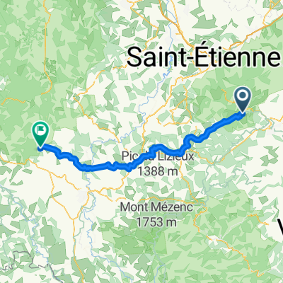
Durch die Montagne de Ardechoise, Col de la Charousse 1251 Hm, Col du Rouvey 1244 Hm, Col des Baraques 1080 Hm (Mittagspause KM 62) nach LAMASTRE
- -:--
- Duration
- 105.1 km
- Distance
- 2,660 m
- Ascent
- 3,131 m
- Descent
- ---
- Avg. speed
- 1,252 m
- Max. altitude

Route quality
Waytypes & surfaces along the route
Waytypes
Road
59.9 km
(57 %)
Quiet road
2.1 km
(2 %)
Surfaces
Paved
25.2 km
(24 %)
Asphalt
25.2 km
(24 %)
Undefined
79.8 km
(76 %)
Continue with Bikemap
Use, edit, or download this cycling route
You would like to ride So 14.8. Ardechoise - Der Norden or customize it for your own trip? Here is what you can do with this Bikemap route:
Free features
- Save this route as favorite or in collections
- Copy & plan your own version of this route
- Split it into stages to create a multi-day tour
- Sync your route with Garmin or Wahoo
Premium features
Free trial for 3 days, or one-time payment. More about Bikemap Premium.
- Navigate this route on iOS & Android
- Export a GPX / KML file of this route
- Create your custom printout (try it for free)
- Download this route for offline navigation
Discover more Premium features.
Get Bikemap PremiumFrom our community
Other popular routes starting in Bourg-Argental
 Bourg-Argental / St Félicien 62km
- Distance
- 62.1 km
- Ascent
- 1,310 m
- Descent
- 1,307 m
- Location
- Bourg-Argental, Auvergne-Rhône-Alpes, France
 TRACOL, por Bourg-Argental
- Distance
- 11.8 km
- Ascent
- 539 m
- Descent
- 57 m
- Location
- Bourg-Argental, Auvergne-Rhône-Alpes, France
 parcours III Bourg St sauveur
- Distance
- 51.2 km
- Ascent
- 981 m
- Descent
- 724 m
- Location
- Bourg-Argental, Auvergne-Rhône-Alpes, France
 L9: Bourg-Argental - Yssingeaux; 58km 870hm
- Distance
- 58 km
- Ascent
- 1,067 m
- Descent
- 751 m
- Location
- Bourg-Argental, Auvergne-Rhône-Alpes, France
 De Route de Badol 1010, Saint-Sauveur-en-Rue à L'Homme 103, Burdignes
- Distance
- 4 km
- Ascent
- 13 m
- Descent
- 163 m
- Location
- Bourg-Argental, Auvergne-Rhône-Alpes, France
 argental
- Distance
- 116 km
- Ascent
- 2,184 m
- Descent
- 2,186 m
- Location
- Bourg-Argental, Auvergne-Rhône-Alpes, France
 Bourg-Argental - Allègre
- Distance
- 100.1 km
- Ascent
- 2,182 m
- Descent
- 1,935 m
- Location
- Bourg-Argental, Auvergne-Rhône-Alpes, France
 Parcours II Bourg Vanosc montfaucon le villard
- Distance
- 59.1 km
- Ascent
- 1,196 m
- Descent
- 935 m
- Location
- Bourg-Argental, Auvergne-Rhône-Alpes, France
Open it in the app