

COL DE LA FAUCILLE (por Mijoux)
A cycling route starting in Gex, Auvergne-Rhône-Alpes, France.
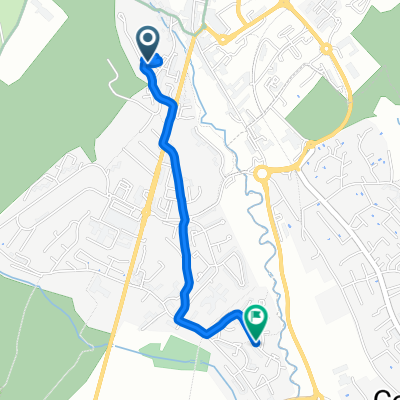
Overview
About this route
- -:--
- Duration
- 8.2 km
- Distance
- 359 m
- Ascent
- 29 m
- Descent
- ---
- Avg. speed
- 1,333 m
- Max. altitude

Route quality
Waytypes & surfaces along the route
Surfaces
Paved
8.1 km
(99 %)
Asphalt
8.1 km
(99 %)
Undefined
0.1 km
(1 %)
Continue with Bikemap
Use, edit, or download this cycling route
You would like to ride COL DE LA FAUCILLE (por Mijoux) or customize it for your own trip? Here is what you can do with this Bikemap route:
Free features
- Save this route as favorite or in collections
- Copy & plan your own version of this route
- Sync your route with Garmin or Wahoo
Premium features
Free trial for 3 days, or one-time payment. More about Bikemap Premium.
- Navigate this route on iOS & Android
- Export a GPX / KML file of this route
- Create your custom printout (try it for free)
- Download this route for offline navigation
Discover more Premium features.
Get Bikemap PremiumFrom our community
Other popular routes starting in Gex
 2004 ツール移動アルプス2
- Distance
- 235.5 km
- Ascent
- 1,581 m
- Descent
- 1,886 m
- Location
- Gex, Auvergne-Rhône-Alpes, France
 Gex - La Faucille - St Sergue - Gex
- Distance
- 60.1 km
- Ascent
- 1,139 m
- Descent
- 1,140 m
- Location
- Gex, Auvergne-Rhône-Alpes, France
 (04) Gex - Messery
- Distance
- 116.9 km
- Ascent
- 1,399 m
- Descent
- 1,576 m
- Location
- Gex, Auvergne-Rhône-Alpes, France
 Faucille unpaved, Colomby de Gex
- Distance
- 34.7 km
- Ascent
- 1,216 m
- Descent
- 1,215 m
- Location
- Gex, Auvergne-Rhône-Alpes, France
 Balcon du Léman
- Distance
- 27.9 km
- Ascent
- 1,241 m
- Descent
- 1,241 m
- Location
- Gex, Auvergne-Rhône-Alpes, France
 retour
- Distance
- 2.4 km
- Ascent
- 23 m
- Descent
- 152 m
- Location
- Gex, Auvergne-Rhône-Alpes, France
 From Gex to Farges
- Distance
- 42.4 km
- Ascent
- 2,098 m
- Descent
- 1,252 m
- Location
- Gex, Auvergne-Rhône-Alpes, France
 4 Gex - Vallée de Joux - Grandson
- Distance
- 93.6 km
- Ascent
- 1,170 m
- Descent
- 1,359 m
- Location
- Gex, Auvergne-Rhône-Alpes, France
Open it in the app