Grünes Band
A cycling route starting in Regnitzlosau, Bavaria, Germany.
Overview
About this route
- -:--
- Duration
- 1,131.8 km
- Distance
- 8,043 m
- Ascent
- 8,588 m
- Descent
- ---
- Avg. speed
- 803 m
- Avg. speed
Route quality
Waytypes & surfaces along the route
Waytypes
Track
300.4 km
(27 %)
Quiet road
255.9 km
(23 %)
Surfaces
Paved
673.4 km
(60 %)
Unpaved
207.9 km
(18 %)
Asphalt
545.3 km
(48 %)
Gravel
116.5 km
(10 %)
Continue with Bikemap
Use, edit, or download this cycling route
You would like to ride Grünes Band or customize it for your own trip? Here is what you can do with this Bikemap route:
Free features
- Save this route as favorite or in collections
- Copy & plan your own version of this route
- Sync your route with Garmin or Wahoo
Premium features
Free trial for 3 days, or one-time payment. More about Bikemap Premium.
- Navigate this route on iOS & Android
- Export a GPX / KML file of this route
- Create your custom printout (try it for free)
- Download this route for offline navigation
Discover more Premium features.
Get Bikemap PremiumFrom our community
Other popular routes starting in Regnitzlosau
- Um Regnitzlosau I
- Distance
- 27.8 km
- Ascent
- 267 m
- Descent
- 267 m
- Location
- Regnitzlosau, Bavaria, Germany
- Esterbauer route
- Distance
- 1,673.4 km
- Ascent
- 1,950 m
- Descent
- 2,415 m
- Location
- Regnitzlosau, Bavaria, Germany
- Grenzerfahrungen Teil 01 #BETA#
- Distance
- 94.9 km
- Ascent
- 729 m
- Descent
- 832 m
- Location
- Regnitzlosau, Bavaria, Germany
- 2023_07 Trojmezí - Hranice pěšky
- Distance
- 7.5 km
- Ascent
- 203 m
- Descent
- 217 m
- Location
- Regnitzlosau, Bavaria, Germany
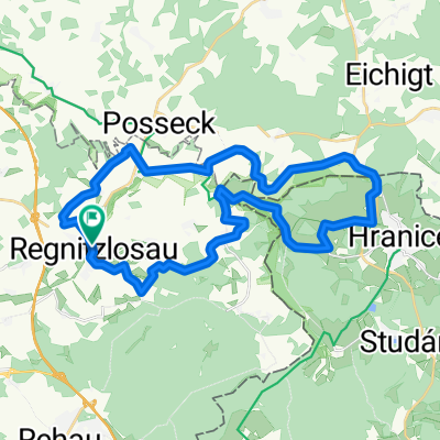
- Raitschin - Faßmannsreuth
- Distance
- 12 km
- Ascent
- 76 m
- Descent
- 149 m
- Location
- Regnitzlosau, Bavaria, Germany
- Iron Curtain Trail (Vogtland)
- Distance
- 29.5 km
- Ascent
- 425 m
- Descent
- 422 m
- Location
- Regnitzlosau, Bavaria, Germany
- GB01 DLE Ludwigsstadt
- Distance
- 91 km
- Ascent
- 939 m
- Descent
- 1,054 m
- Location
- Regnitzlosau, Bavaria, Germany
- Grenz-Radtour bis Wittingen geplant
- Distance
- 870.1 km
- Ascent
- 2,643 m
- Descent
- 3,154 m
- Location
- Regnitzlosau, Bavaria, Germany
Open it in the app