

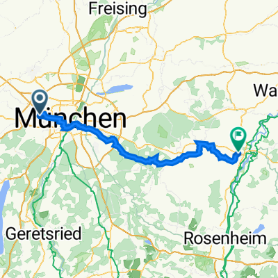
PWOZKS 1: Pasing-Staudham, 75,8km 410hm
A cycling route starting in Pasing, Bavaria, Germany.
Overview
About this route
Pasing - Untergiesing - Obergiesing - Ramersdorf - Berg am Laim - (Panoramaweg Isar-Inn) - Solalinden - Keferloh - Grasbrunn - Harthausen - Wolfersberg - Deinhofen - Reit - Falkenberg - Baumhau - Taglaching - Pierstling - Gindlkofen - Grafing - Gasteig - Traxl - Pollmoos - Steinhöring - Tulling - Elchering - Springlbach - Obermoos - Untermoos - Lutzhäusl - Hilgen - Pfaffing
Pfaffinger Hof, Hauptstraße 2, Paffing oder Landwirtschaft, Münchner Str. 30, 83512 Wasserburg am Inn
- -:--
- Duration
- 75.8 km
- Distance
- 656 m
- Ascent
- 699 m
- Descent
- ---
- Avg. speed
- 626 m
- Max. altitude

Route quality
Waytypes & surfaces along the route
Waytypes
Quiet road
37.9 km
(50 %)
Track
14.4 km
(19 %)
Surfaces
Paved
59.1 km
(78 %)
Unpaved
14.4 km
(19 %)
Asphalt
58.3 km
(77 %)
Gravel
11.4 km
(15 %)
Route highlights
Points of interest along the route

Point of interest after 7 km
Rondell am Arnulfsteg
Point of interest after 11.7 km
Wittelsbacher Brücke
Point of interest after 26 km
Wegkapelle Solalinden
Point of interest after 27.6 km
St. Aegidius - sehr alte romanische Kirche
Point of interest after 27.8 km
Kapelle St Maria Keferloh

Point of interest after 68.9 km
Pfaffinger Hof, Hauptstraße 2, Paffing
Point of interest after 73.2 km
?? Badestelle ??
Accommodation after 75.7 km
Landwirtschaft, Münchner Str. 30, 83512 Wasserburg am Inn
Continue with Bikemap
Use, edit, or download this cycling route
You would like to ride PWOZKS 1: Pasing-Staudham, 75,8km 410hm or customize it for your own trip? Here is what you can do with this Bikemap route:
Free features
- Save this route as favorite or in collections
- Copy & plan your own version of this route
- Sync your route with Garmin or Wahoo
Premium features
Free trial for 3 days, or one-time payment. More about Bikemap Premium.
- Navigate this route on iOS & Android
- Export a GPX / KML file of this route
- Create your custom printout (try it for free)
- Download this route for offline navigation
Discover more Premium features.
Get Bikemap PremiumFrom our community
Other popular routes starting in Pasing
 Kleine Runde
- Distance
- 34.5 km
- Ascent
- 154 m
- Descent
- 152 m
- Location
- Pasing, Bavaria, Germany
 Pasing - Westpak - Hirschgarten - Pasing
- Distance
- 20 km
- Ascent
- 70 m
- Descent
- 70 m
- Location
- Pasing, Bavaria, Germany
 Pasing-Obermenzing, München nach Starnberg und zurück entlang der Würm mit Aussichtspunkt auf den Starnberger See und die Alpen
- Distance
- 45.9 km
- Ascent
- 611 m
- Descent
- 611 m
- Location
- Pasing, Bavaria, Germany
 All1: Pasing - Kaufering; 71,8km - 510hm
- Distance
- 71.9 km
- Ascent
- 655 m
- Descent
- 603 m
- Location
- Pasing, Bavaria, Germany
 Obermenzing - Biergarten Gräfelfing und zurück
- Distance
- 26.3 km
- Ascent
- 42 m
- Descent
- 42 m
- Location
- Pasing, Bavaria, Germany
 PWOZKS 1: Pasing-Staudham, 75,8km 410hm
- Distance
- 75.8 km
- Ascent
- 656 m
- Descent
- 699 m
- Location
- Pasing, Bavaria, Germany
 Kleinhadern - Dachau
- Distance
- 18.7 km
- Ascent
- 516 m
- Descent
- 561 m
- Location
- Pasing, Bavaria, Germany
 Muenchen - Ammersee
- Distance
- 76.5 km
- Ascent
- 304 m
- Descent
- 304 m
- Location
- Pasing, Bavaria, Germany
Open it in the app