Elogio della Foresta fossile della Stura di Lanzo
A cycling route starting in Venaria Reale, Piedmont, Italy.
Overview
About this route
The stumps of Glyptostrobus europaeus can be observed (depending on the conditions of the stream) on both banks of the Stura di Lanzo over a length of about 500 meters.
On the right bank, access is from the hamlets of Vastalla (Ciriè) and Grange di Nole. On the left bank, access is from Villanova and Nole. Signage along the Corona Verde cycle path.
The recommendation can only be a loop. The suggested loop runs along both banks of this stream, known for the biological quality of its water and the riparian environment.
A rather challenging suggestion (63 km, the longest in the guide) that runs at least 50% on natural-surfaced trails. In return, much of the ride is on paths reserved for pedestrians and bicycles. Another incentive comes from the many points of interest: besides the fossil stumps being praised, mention should be made of the springs on the right bank at Grange di Nole and, on the left bank, between Nole and Villanova, the Goret Oasis, a remarkable example of naturalistic recovery of a quarry area. Also, the Devil's Bridge at Lanzo and the La Mandria Nature Park.
Venaria – La Mandria Park (Villa Laghi, Cascina Oslera) – roundabout on SP 1 – Verde – Robassomero – Vastalla – Stura di Lanzo, fossil forest – Grange di Nole – San Firmino (Fiano) – Cafasse – bridge over the Stura – Villanova – Mathi – Balangero – Lanzo (Devil's Bridge) – Balangero – Mathi – Grosso – Villanova – Nole (Goret Oasis) – fossil forest – Vastalla – Pich – Ceretta (San Maurizio) – Francia – Caselle – Borgaro – cycle bridge over the Stura – Venaria.
Train stations in Venaria and in the towns along the route.
- -:--
- Duration
- 62.5 km
- Distance
- 416 m
- Ascent
- 416 m
- Descent
- ---
- Avg. speed
- 472 m
- Max. altitude
Route quality
Waytypes & surfaces along the route
Waytypes
Track
22.5 km
(36 %)
Quiet road
19.4 km
(31 %)
Surfaces
Paved
26.9 km
(43 %)
Unpaved
18.7 km
(30 %)
Asphalt
25 km
(40 %)
Loose gravel
9.4 km
(15 %)
Route highlights
Points of interest along the route
Point of interest after 3.8 km
Borgo Castello

Point of interest after 7 km
Villa dei Laghi
Point of interest after 7.8 km
Cascina Oslera
Point of interest after 15 km
Foresta Fossile

Point of interest after 44.9 km
Oasi Naturalistica dei Goret

Point of interest after 45.2 km
Foresta Fossile

Point of interest after 45.9 km
Sentiero delle Fontane
Continue with Bikemap
Use, edit, or download this cycling route
You would like to ride Elogio della Foresta fossile della Stura di Lanzo or customize it for your own trip? Here is what you can do with this Bikemap route:
Free features
- Save this route as favorite or in collections
- Copy & plan your own version of this route
- Sync your route with Garmin or Wahoo
Premium features
Free trial for 3 days, or one-time payment. More about Bikemap Premium.
- Navigate this route on iOS & Android
- Export a GPX / KML file of this route
- Create your custom printout (try it for free)
- Download this route for offline navigation
Discover more Premium features.
Get Bikemap PremiumFrom our community
Other popular routes starting in Venaria Reale
 Corsa del re - 30km
- Distance
- 30 km
- Ascent
- 149 m
- Descent
- 140 m
- Location
- Venaria Reale, Piedmont, Italy
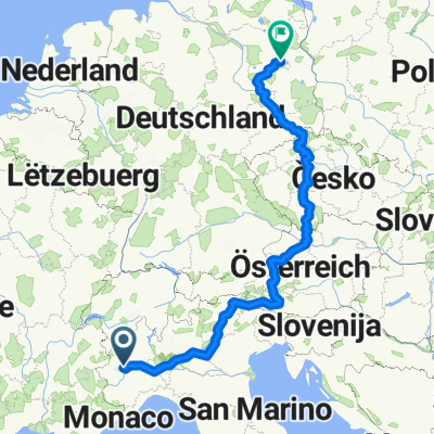
 Torino-Berlino (Eurovelo 7)
- Distance
- 1,874.2 km
- Ascent
- 2,682 m
- Descent
- 2,896 m
- Location
- Venaria Reale, Piedmont, Italy
 Gravel Venaria Lanzo
- Distance
- 51.5 km
- Ascent
- 222 m
- Descent
- 221 m
- Location
- Venaria Reale, Piedmont, Italy
 bike lane
- Distance
- 4.7 km
- Ascent
- 13 m
- Descent
- 12 m
- Location
- Venaria Reale, Piedmont, Italy
 Elogio della Foresta fossile della Stura di Lanzo
- Distance
- 62.5 km
- Ascent
- 416 m
- Descent
- 416 m
- Location
- Venaria Reale, Piedmont, Italy
 Percorso dentro La Mandria
- Distance
- 21 km
- Ascent
- 97 m
- Descent
- 97 m
- Location
- Venaria Reale, Piedmont, Italy
 Parco La Mandria: Ponte Verde-Bizzarria and back
- Distance
- 14.5 km
- Ascent
- 110 m
- Descent
- 109 m
- Location
- Venaria Reale, Piedmont, Italy
 Pedemontana e Vaude
- Distance
- 71.5 km
- Ascent
- 463 m
- Descent
- 463 m
- Location
- Venaria Reale, Piedmont, Italy
Open it in the app


