

Rund um den Rossberg
A cycling route starting in Feuerthalen, Canton of Zurich, Switzerland.
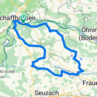
Overview
About this route
Beautiful route through fields, forest, and meadows
- -:--
- Duration
- 62.1 km
- Distance
- 470 m
- Ascent
- 470 m
- Descent
- ---
- Avg. speed
- ---
- Max. altitude

Route quality
Waytypes & surfaces along the route
Waytypes
Road
14.9 km
(24 %)
Quiet road
9.3 km
(15 %)
Surfaces
Paved
57.2 km
(92 %)
Unpaved
1.2 km
(2 %)
Asphalt
54.1 km
(87 %)
Paved (undefined)
3.1 km
(5 %)
Continue with Bikemap
Use, edit, or download this cycling route
You would like to ride Rund um den Rossberg or customize it for your own trip? Here is what you can do with this Bikemap route:
Free features
- Save this route as favorite or in collections
- Copy & plan your own version of this route
- Sync your route with Garmin or Wahoo
Premium features
Free trial for 3 days, or one-time payment. More about Bikemap Premium.
- Navigate this route on iOS & Android
- Export a GPX / KML file of this route
- Create your custom printout (try it for free)
- Download this route for offline navigation
Discover more Premium features.
Get Bikemap PremiumFrom our community
Other popular routes starting in Feuerthalen
 Feuerthalen-Zeller See
- Distance
- 71.3 km
- Ascent
- 433 m
- Descent
- 433 m
- Location
- Feuerthalen, Canton of Zurich, Switzerland
 Weinland-Tour
- Distance
- 59.5 km
- Ascent
- 406 m
- Descent
- 406 m
- Location
- Feuerthalen, Canton of Zurich, Switzerland
 Moderate Route in Schaffhausen
- Distance
- 39 km
- Ascent
- 0 m
- Descent
- 0 m
- Location
- Feuerthalen, Canton of Zurich, Switzerland
 Tag3 Büsingen - Murg
- Distance
- 74.6 km
- Ascent
- 207 m
- Descent
- 306 m
- Location
- Feuerthalen, Canton of Zurich, Switzerland
 04.2012 Büsingen nach Neuenburg
- Distance
- 148.5 km
- Ascent
- 273 m
- Descent
- 447 m
- Location
- Feuerthalen, Canton of Zurich, Switzerland
 Seerugge West 1
- Distance
- 57.9 km
- Ascent
- 392 m
- Descent
- 392 m
- Location
- Feuerthalen, Canton of Zurich, Switzerland
 Büsingen - Moos
- Distance
- 37.7 km
- Ascent
- 717 m
- Descent
- 670 m
- Location
- Feuerthalen, Canton of Zurich, Switzerland
 Feuerthalen - Ellikon an der Thur
- Distance
- 50.2 km
- Ascent
- 377 m
- Descent
- 377 m
- Location
- Feuerthalen, Canton of Zurich, Switzerland
Open it in the app