

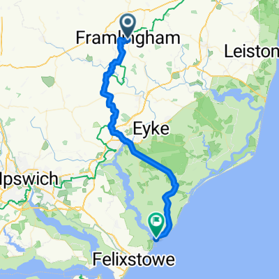
Suffolk 100 miler
A cycling route starting in Framlingham, England, United Kingdom.
Overview
About this route
A fairly flat route on mainly quite country roads. It only gets busier around Ipswich.
The wind was in my face all the way from Framlingham until pretty much Glemsford. The wind was behind me on the way back but I think it is slightly more hilly on the way back!
- -:--
- Duration
- 161.3 km
- Distance
- 386 m
- Ascent
- 389 m
- Descent
- ---
- Avg. speed
- ---
- Max. altitude
Route quality
Waytypes & surfaces along the route
Waytypes
Road
83 km
(51 %)
Quiet road
41.5 km
(26 %)
Surfaces
Paved
22.2 km
(14 %)
Asphalt
22.2 km
(14 %)
Undefined
139.2 km
(86 %)
Continue with Bikemap
Use, edit, or download this cycling route
You would like to ride Suffolk 100 miler or customize it for your own trip? Here is what you can do with this Bikemap route:
Free features
- Save this route as favorite or in collections
- Copy & plan your own version of this route
- Split it into stages to create a multi-day tour
- Sync your route with Garmin or Wahoo
Premium features
Free trial for 3 days, or one-time payment. More about Bikemap Premium.
- Navigate this route on iOS & Android
- Export a GPX / KML file of this route
- Create your custom printout (try it for free)
- Download this route for offline navigation
Discover more Premium features.
Get Bikemap PremiumFrom our community
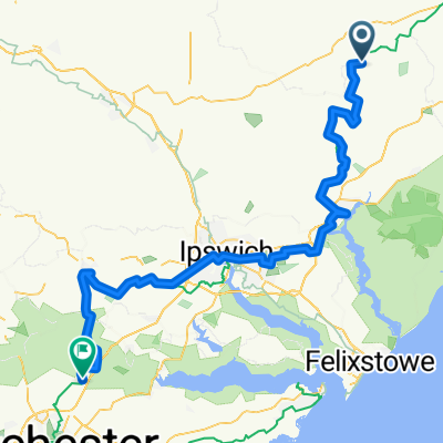
Other popular routes starting in Framlingham
 Framlingham to Eye Loop
- Distance
- 80.9 km
- Ascent
- 161 m
- Descent
- 157 m
- Location
- Framlingham, England, United Kingdom
 Woodsford Rides 2019 day 2b
- Distance
- 37.7 km
- Ascent
- 146 m
- Descent
- 173 m
- Location
- Framlingham, England, United Kingdom
 WALK - Framlingham, Dennington, Badingham (11.2 miles)
- Distance
- 18 km
- Ascent
- 109 m
- Descent
- 110 m
- Location
- Framlingham, England, United Kingdom
 WALK - Framlingham to Dennington (8.6 miles)
- Distance
- 13.9 km
- Ascent
- 77 m
- Descent
- 78 m
- Location
- Framlingham, England, United Kingdom
 2020 Challenge D22
- Distance
- 74.7 km
- Ascent
- 285 m
- Descent
- 278 m
- Location
- Framlingham, England, United Kingdom
 Suffolk Norfolk 100 miler
- Distance
- 163.4 km
- Ascent
- 337 m
- Descent
- 337 m
- Location
- Framlingham, England, United Kingdom
 first leg
- Distance
- 56,619.8 km
- Ascent
- 55 m
- Descent
- 93 m
- Location
- Framlingham, England, United Kingdom
 Suffolk 100 miler
- Distance
- 161.3 km
- Ascent
- 386 m
- Descent
- 389 m
- Location
- Framlingham, England, United Kingdom
Open it in the app