

Bärenstein-05-670hm
A cycling route starting in Pirna, Saxony, Germany.
Overview
About this route
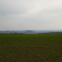
Quite a challenging route for the experienced MTB rider. Some carry sections as well as technically demanding parts make the ride very varied. Not to forget the beautiful nature with wonderful views of the Elbe Sandstone Mountains. The last section from Pötscha invites relaxed cycling or to enjoy a Radler (beer-shandy). In wet conditions, the difficulty level increases significantly; night rides are only recommended for those familiar with the area.
- -:--
- Duration
- 30.8 km
- Distance
- 0 m
- Ascent
- 0 m
- Descent
- ---
- Avg. speed
- ---
- Max. altitude

Continue with Bikemap
Use, edit, or download this cycling route
You would like to ride Bärenstein-05-670hm or customize it for your own trip? Here is what you can do with this Bikemap route:
Free features
- Save this route as favorite or in collections
- Copy & plan your own version of this route
- Sync your route with Garmin or Wahoo
Premium features
Free trial for 3 days, or one-time payment. More about Bikemap Premium.
- Navigate this route on iOS & Android
- Export a GPX / KML file of this route
- Create your custom printout (try it for free)
- Download this route for offline navigation
Discover more Premium features.
Get Bikemap PremiumFrom our community
Other popular routes starting in Pirna
 Herbstrunde - auf und ab
- Distance
- 42.6 km
- Ascent
- 588 m
- Descent
- 588 m
- Location
- Pirna, Saxony, Germany
 Radtour vom 18.05.2019
- Distance
- 84.9 km
- Ascent
- 680 m
- Descent
- 680 m
- Location
- Pirna, Saxony, Germany
 Bärenstein-05-670hm
- Distance
- 30.8 km
- Ascent
- 0 m
- Descent
- 0 m
- Location
- Pirna, Saxony, Germany
 Stolpen-Neustadt-Hohnstein
- Distance
- 73.5 km
- Ascent
- 684 m
- Descent
- 682 m
- Location
- Pirna, Saxony, Germany
 durch den Uttewalder Grund
- Distance
- 30.5 km
- Ascent
- 273 m
- Descent
- 273 m
- Location
- Pirna, Saxony, Germany
 Ostern im Elbsandstein-Gebirge
- Distance
- 72.4 km
- Ascent
- 1,389 m
- Descent
- 1,334 m
- Location
- Pirna, Saxony, Germany
 Müglitztaltour - 22.10.2011
- Distance
- 21.1 km
- Ascent
- 378 m
- Descent
- 371 m
- Location
- Pirna, Saxony, Germany
 sächsische schweiz
- Distance
- 92.6 km
- Ascent
- 1,762 m
- Descent
- 1,700 m
- Location
- Pirna, Saxony, Germany
Open it in the app