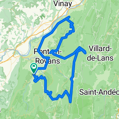
- 67.8 km
- 1,808 m
- 1,808 m
- Saint-Jean-en-Royans, Auvergne-Rh么ne-Alpes, France
Drome 2011 - 03
A cycling route starting in Saint-Jean-en-Royans, Auvergne-Rh么ne-Alpes, France.
Overview
About this route
- -:--
- Duration
- 67.8 km
- Distance
- 1,351 m
- Ascent
- 1,351 m
- Descent
- ---
- Avg. speed
- ---
- Max. altitude
created this 14 years ago
Route quality
Waytypes & surfaces along the route
Waytypes
Road
27.1 km
(40 %)
Quiet road
9.5 km
(14 %)
Surfaces
Paved
56.9 km
(84 %)
Unpaved
0.7 km
(1 %)
Asphalt
56.9 km
(84 %)
Ground
0.7 km
(1 %)
Undefined
10.2 km
(15 %)
Route highlights
Points of interest along the route
Point of interest after 12.1 km
<b>Col de la Croix</b> <br / >FR-26-0722
Point of interest after 13.5 km
<b>Col du Tunnel du Pionnier</b> <br />FR-26-1029c
Point of interest after 18.8 km
<b>Col de la Portette</b> </br>FR-26-1175
Point of interest after 22.3 km
<b>Col du Rioupeysson</b> <br />FR-26-1195c
Point of interest after 25.7 km
<b>Pas de Logue</b> <br />FR-26-1312a
Point of interest after 32.7 km
<b>Col de la Bataille</b> <br />FR-26-1313
Point of interest after 35.1 km
<b>Pas de Chovet</b> <br />FR-26-1380
Point of interest after 41.4 km
<b>Col du Lion</b> <br />FR-26-1192
Point of interest after 43.5 km
<b>Pas du Grand Echaillon</b> <br>FR-26-1200a
Point of interest after 50.2 km
<b>Col du P茅ril</b> <br />FR-26-0970c
Point of interest after 54.6 km
<b>Col de Bioux</b> FR-26-0790a
Point of interest after 62.8 km
<b>Col de Panavare</b> <br />FR-26-0425
Continue with Bikemap
Use, edit, or download this cycling route
You would like to ride Drome 2011 - 03 or customize it for your own trip? Here is what you can do with this Bikemap route:
Free features
- Save this route as favorite or in collections
- Copy & plan your own version of this route
- Sync your route with Garmin or Wahoo
Premium features
Free trial for 3 days, or one-time payment. More about Bikemap Premium.
- Navigate this route on iOS & Android
- Export a GPX / KML file of this route
- Create your custom printout (try it for free)
- Download this route for offline navigation
Discover more Premium features.
Get Bikemap PremiumFrom our community
Other popular routes starting in Saint-Jean-en-Royans
- Drome 2011 - 02
- Avenue du Sert 2, Saint-Jean-en-Royans nach Avenue du Sert 2, Saint-Jean-en-Royans
- 77.4 km
- 2,019 m
- 2,018 m
- Saint-Jean-en-Royans, Auvergne-Rh么ne-Alpes, France
- 20150402 - Saint Jean Lac de bouvante
- 33.1 km
- 642 m
- 646 m
- Saint-Jean-en-Royans, Auvergne-Rh么ne-Alpes, France
- FA14 St Jean-Heurieux
- 122.7 km
- 952 m
- 1,026 m
- Saint-Jean-en-Royans, Auvergne-Rh么ne-Alpes, France
- Womens 100 2017
- 99.8 km
- 1,822 m
- 1,822 m
- Saint-Jean-en-Royans, Auvergne-Rh么ne-Alpes, France
- Combe Lavel Rundtour 50km
- 37.8 km
- 1,821 m
- 1,807 m
- Saint-Jean-en-Royans, Auvergne-Rh么ne-Alpes, France
- 20150331 - Saint-Jean en Royans to Bouvante le bas
- 24.4 km
- 577 m
- 590 m
- Saint-Jean-en-Royans, Auvergne-Rh么ne-Alpes, France
- cognin/st agnan/carri/combe laval
- 122.3 km
- 2,302 m
- 2,302 m
- Saint-Jean-en-Royans, Auvergne-Rh么ne-Alpes, France
Open it in the app


