sundsvall-harnösand etapp2 /teil5
A cycling route starting in Stockvik, Västernorrland County, Sweden.
Overview
About this route
- -:--
- Duration
- 68 km
- Distance
- 328 m
- Ascent
- 340 m
- Descent
- ---
- Avg. speed
- ---
- Max. altitude
Route quality
Waytypes & surfaces along the route
Waytypes
Cycleway
26.5 km
(39 %)
Road
20.1 km
(30 %)
Surfaces
Paved
56.2 km
(83 %)
Unpaved
1.4 km
(2 %)
Asphalt
56.2 km
(83 %)
Unpaved (undefined)
1 km
(1 %)
Continue with Bikemap
Use, edit, or download this cycling route
You would like to ride sundsvall-harnösand etapp2 /teil5 or customize it for your own trip? Here is what you can do with this Bikemap route:
Free features
- Save this route as favorite or in collections
- Copy & plan your own version of this route
- Sync your route with Garmin or Wahoo
Premium features
Free trial for 3 days, or one-time payment. More about Bikemap Premium.
- Navigate this route on iOS & Android
- Export a GPX / KML file of this route
- Create your custom printout (try it for free)
- Download this route for offline navigation
Discover more Premium features.
Get Bikemap PremiumFrom our community
Other popular routes starting in Stockvik
- sundsvall-harnösand etapp2 /teil5
- Distance
- 68 km
- Ascent
- 328 m
- Descent
- 340 m
- Location
- Stockvik, Västernorrland County, Sweden
- Norrstigen, Sundsvall to Kustvägen, Njurunda
- Distance
- 19.8 km
- Ascent
- 118 m
- Descent
- 133 m
- Location
- Stockvik, Västernorrland County, Sweden
- Norrstigen 15 nach Fabriksgatan 16C
- Distance
- 173.6 km
- Ascent
- 2,177 m
- Descent
- 2,196 m
- Location
- Stockvik, Västernorrland County, Sweden
- Norrstigen, Sundsvall to Vivstavarvstjärnen 1, Timrå
- Distance
- 18.1 km
- Ascent
- 234 m
- Descent
- 218 m
- Location
- Stockvik, Västernorrland County, Sweden
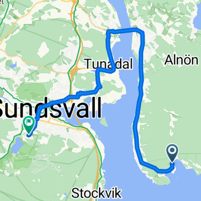
- Bänkåsviken, Alnö to Paviljongvägen, Sundsvall
- Distance
- 22.9 km
- Ascent
- 231 m
- Descent
- 142 m
- Location
- Stockvik, Västernorrland County, Sweden
Open it in the app