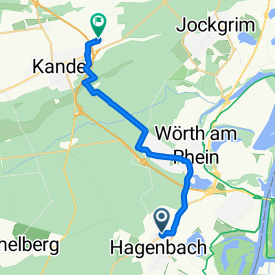
Hagenbach-Scherhol-Pfaffenschlick-Scherhol-Reisdorf-Offenbach
A cycling route starting in Hagenbach, Rhineland-Palatinate, Germany.
Overview
About this route
Beautiful ride through the Northern Vosges. Climbs manageable for moderately trained riders
- -:--
- Duration
- 113 km
- Distance
- 803 m
- Ascent
- 775 m
- Descent
- ---
- Avg. speed
- ---
- Max. altitude
Route quality
Waytypes & surfaces along the route
Waytypes
Road
23.7 km
(21 %)
Track
14.7 km
(13 %)
Surfaces
Paved
98.3 km
(87 %)
Unpaved
11.3 km
(10 %)
Asphalt
94.9 km
(84 %)
Unpaved (undefined)
9 km
(8 %)
Continue with Bikemap
Use, edit, or download this cycling route
You would like to ride Hagenbach-Scherhol-Pfaffenschlick-Scherhol-Reisdorf-Offenbach or customize it for your own trip? Here is what you can do with this Bikemap route:
Free features
- Save this route as favorite or in collections
- Copy & plan your own version of this route
- Split it into stages to create a multi-day tour
- Sync your route with Garmin or Wahoo
Premium features
Free trial for 3 days, or one-time payment. More about Bikemap Premium.
- Navigate this route on iOS & Android
- Export a GPX / KML file of this route
- Create your custom printout (try it for free)
- Download this route for offline navigation
Discover more Premium features.
Get Bikemap PremiumFrom our community
Other popular routes starting in Hagenbach
- Hagenbach-Scherhol-Pfaffenschlick-Scherhol-Reisdorf-Offenbach
- Distance
- 113 km
- Ascent
- 803 m
- Descent
- 775 m
- Location
- Hagenbach, Rhineland-Palatinate, Germany
- Hagenbach-Lauterbourg-Wissemburg-Reisdorf-Bad Bergzabern-Kandel-Wörth-Hagenbach CLONED FROM ROUTE 737738
- Distance
- 79.3 km
- Ascent
- 297 m
- Descent
- 299 m
- Location
- Hagenbach, Rhineland-Palatinate, Germany
- ?Zapf Kandel am Holderbühl 2
- Distance
- 11.5 km
- Ascent
- 10 m
- Descent
- 0 m
- Location
- Hagenbach, Rhineland-Palatinate, Germany
- Rietburgstraße 7, Hagenbach nach Thiebauthstraße 10-14, Ettlingen
- Distance
- 27.1 km
- Ascent
- 54 m
- Descent
- 19 m
- Location
- Hagenbach, Rhineland-Palatinate, Germany
- rotbuschklause neustadt
- Distance
- 98.9 km
- Ascent
- 398 m
- Descent
- 399 m
- Location
- Hagenbach, Rhineland-Palatinate, Germany
- Hagenbach-Beinheim-Hatten-Scheibenhardt-Hagenbach
- Distance
- 67.4 km
- Ascent
- 105 m
- Descent
- 108 m
- Location
- Hagenbach, Rhineland-Palatinate, Germany
- Bienwald
- Distance
- 38.8 km
- Ascent
- 87 m
- Descent
- 86 m
- Location
- Hagenbach, Rhineland-Palatinate, Germany
- Hagenbach-Lauterbourg-Wissemburg-Reisdorf-Bad Bergzabern-Kandel-Wörth-Hagenbach CLONED FROM ROUTE 737738
- Distance
- 79.3 km
- Ascent
- 303 m
- Descent
- 306 m
- Location
- Hagenbach, Rhineland-Palatinate, Germany
Open it in the app