

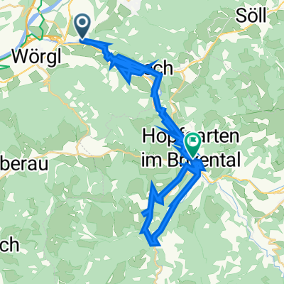
Kirchbichl-Ellmau-Kitzbühel
A cycling route starting in Angath, Tyrol, Austria.
Overview
About this route
Übernachten im Buchberghof Gemeinde Oberndorf in Tirol
- -:--
- Duration
- 73.5 km
- Distance
- 1,131 m
- Ascent
- 1,113 m
- Descent
- ---
- Avg. speed
- 824 m
- Max. altitude

Route quality
Waytypes & surfaces along the route
Waytypes
Quiet road
47.8 km
(65 %)
Track
8.1 km
(11 %)
Surfaces
Paved
60.3 km
(82 %)
Unpaved
3.7 km
(5 %)
Asphalt
59.5 km
(81 %)
Gravel
2.9 km
(4 %)
Continue with Bikemap
Use, edit, or download this cycling route
You would like to ride Kirchbichl-Ellmau-Kitzbühel or customize it for your own trip? Here is what you can do with this Bikemap route:
Free features
- Save this route as favorite or in collections
- Copy & plan your own version of this route
- Sync your route with Garmin or Wahoo
Premium features
Free trial for 3 days, or one-time payment. More about Bikemap Premium.
- Navigate this route on iOS & Android
- Export a GPX / KML file of this route
- Create your custom printout (try it for free)
- Download this route for offline navigation
Discover more Premium features.
Get Bikemap PremiumFrom our community
Other popular routes starting in Angath
 Wörgl über Glantersberg, Schwaigerberg,. Schwarzkogel zur Gamskogelhütte und retour
- Distance
- 60 km
- Ascent
- 1,255 m
- Descent
- 1,252 m
- Location
- Angath, Tyrol, Austria
 Wörgl - Wiegalm - Wörgl
- Distance
- 64.9 km
- Ascent
- 1,165 m
- Descent
- 1,165 m
- Location
- Angath, Tyrol, Austria
 Wörgl to Neukirchen am Großvenediger
- Distance
- 73.8 km
- Ascent
- 1,554 m
- Descent
- 1,201 m
- Location
- Angath, Tyrol, Austria
 🚴♀️E*Bike🇦🇹 Wörgl-Brixental 14.07.19.
- Distance
- 25.3 km
- Ascent
- 270 m
- Descent
- 270 m
- Location
- Angath, Tyrol, Austria
 Lofererstraße 29, Kirchbichl nach Brixentaler Straße 46, Hopfgarten-Markt
- Distance
- 41.3 km
- Ascent
- 337 m
- Descent
- 280 m
- Location
- Angath, Tyrol, Austria
 Innradweg: Angath - Rosenheim
- Distance
- 26.2 km
- Ascent
- 110 m
- Descent
- 142 m
- Location
- Angath, Tyrol, Austria
 Kirchbichl-Angerberg-Wörgl
- Distance
- 22.9 km
- Ascent
- 270 m
- Descent
- 269 m
- Location
- Angath, Tyrol, Austria
 Österreich 2021
- Distance
- 892 km
- Ascent
- 2,496 m
- Descent
- 2,493 m
- Location
- Angath, Tyrol, Austria
Open it in the app