

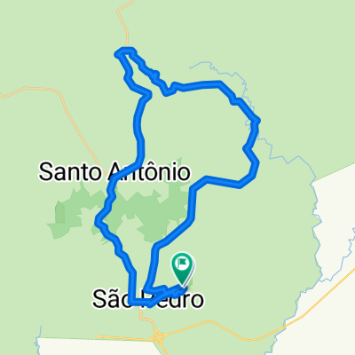
Rota do Coclovis 1
A cycling route starting in São Pedro, São Paulo, Brazil.
Overview
About this route
- -:--
- Duration
- 43.5 km
- Distance
- 351 m
- Ascent
- 743 m
- Descent
- ---
- Avg. speed
- ---
- Max. altitude
Route quality
Waytypes & surfaces along the route
Waytypes
Quiet road
23.5 km
(54 %)
Road
0.4 km
(1 %)
Undefined
19.6 km
(45 %)
Surfaces
Paved
24.4 km
(56 %)
Unpaved
1.7 km
(4 %)
Asphalt
24.4 km
(56 %)
Unpaved (undefined)
1.7 km
(4 %)
Undefined
17.4 km
(40 %)
Route highlights
Points of interest along the route

Point of interest after 0 km
Inicio, de carro até o topo da serra no Mosteiro de Santo Antonio.

Point of interest after 4.3 km
Até aqui é asfalto, depois saímos por estradas de terra.

Point of interest after 14.9 km

Point of interest after 23.6 km
Aqui acaba a terra e começa o asfalto.

Point of interest after 36.9 km
Descida da serra, cuidado com os freios.

Point of interest after 43.5 km
Chegada em casa.
Continue with Bikemap
Use, edit, or download this cycling route
You would like to ride Rota do Coclovis 1 or customize it for your own trip? Here is what you can do with this Bikemap route:
Free features
- Save this route as favorite or in collections
- Copy & plan your own version of this route
- Sync your route with Garmin or Wahoo
Premium features
Free trial for 3 days, or one-time payment. More about Bikemap Premium.
- Navigate this route on iOS & Android
- Export a GPX / KML file of this route
- Create your custom printout (try it for free)
- Download this route for offline navigation
Discover more Premium features.
Get Bikemap PremiumFrom our community
Other popular routes starting in São Pedro
 Trilha do Querozene
- Distance
- 38 km
- Ascent
- 652 m
- Descent
- 635 m
- Location
- São Pedro, São Paulo, Brazil
 Trilha da Ponte Quebrada em São Pedro
- Distance
- 24.6 km
- Ascent
- 363 m
- Descent
- 345 m
- Location
- São Pedro, São Paulo, Brazil
 Trilha da Interligação das Pistas
- Distance
- 58.6 km
- Ascent
- 809 m
- Descent
- 799 m
- Location
- São Pedro, São Paulo, Brazil
 Serra Brotas
- Distance
- 51 km
- Ascent
- 530 m
- Descent
- 529 m
- Location
- São Pedro, São Paulo, Brazil
 Alpes
Alpes- Distance
- 19 km
- Ascent
- 103 m
- Descent
- 101 m
- Location
- São Pedro, São Paulo, Brazil
 Caminho da Fé saindo de São Pedro a Aparecida
- Distance
- 577.4 km
- Ascent
- 3,038 m
- Descent
- 3,078 m
- Location
- São Pedro, São Paulo, Brazil
 São Pedro - Torrinha
- Distance
- 38.4 km
- Ascent
- 303 m
- Descent
- 440 m
- Location
- São Pedro, São Paulo, Brazil
 Contorno de Patrimonio - Brotas
- Distance
- 30.7 km
- Ascent
- 345 m
- Descent
- 344 m
- Location
- São Pedro, São Paulo, Brazil
Open it in the app