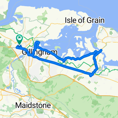
ROUTE 179: 15.2ml
A cycling route starting in Strood, England, United Kingdom.
Overview
About this route
Lower Higham, Gore Green, Buckland, Cliffe, Cooling, High Halstow, Sharnal Street, Beluncle, Hoo, Chattenden, The Mount, Lee Green.
- -:--
- Duration
- 24.6 km
- Distance
- 182 m
- Ascent
- 181 m
- Descent
- ---
- Avg. speed
- 59 m
- Avg. speed
Route quality
Waytypes & surfaces along the route
Waytypes
Road
11.8 km
(48 %)
Quiet road
9.6 km
(39 %)
Surfaces
Paved
3.7 km
(15 %)
Asphalt
3.7 km
(15 %)
Undefined
20.8 km
(85 %)
Continue with Bikemap
Use, edit, or download this cycling route
You would like to ride ROUTE 179: 15.2ml or customize it for your own trip? Here is what you can do with this Bikemap route:
Free features
- Save this route as favorite or in collections
- Copy & plan your own version of this route
- Sync your route with Garmin or Wahoo
Premium features
Free trial for 3 days, or one-time payment. More about Bikemap Premium.
- Navigate this route on iOS & Android
- Export a GPX / KML file of this route
- Create your custom printout (try it for free)
- Download this route for offline navigation
Discover more Premium features.
Get Bikemap PremiumFrom our community
Other popular routes starting in Strood
- Strood & ROCHESTER circular ride
- Distance
- 18.6 km
- Ascent
- 247 m
- Descent
- 241 m
- Location
- Strood, England, United Kingdom
- Northcote Road 1 to Bryant Road 26
- Distance
- 39.5 km
- Ascent
- 500 m
- Descent
- 505 m
- Location
- Strood, England, United Kingdom
- Cobham easy 15.8?
- Distance
- 15.8 km
- Ascent
- 113 m
- Descent
- 123 m
- Location
- Strood, England, United Kingdom
- 20 Km in Cliffe
- Distance
- 20.1 km
- Ascent
- 130 m
- Descent
- 122 m
- Location
- Strood, England, United Kingdom
- Shorter Cobham No big hills
- Distance
- 42.2 km
- Ascent
- 264 m
- Descent
- 264 m
- Location
- Strood, England, United Kingdom
- Cobham Gravesend Pepperhill
- Distance
- 42.2 km
- Ascent
- 0 m
- Descent
- 0 m
- Location
- Strood, England, United Kingdom
- Cobham New 20 (30)
- Distance
- 30.1 km
- Ascent
- 253 m
- Descent
- 252 m
- Location
- Strood, England, United Kingdom
- ROUTE 179: 15.2ml
- Distance
- 24.6 km
- Ascent
- 182 m
- Descent
- 181 m
- Location
- Strood, England, United Kingdom
Open it in the app