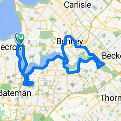
Airport Loop
A cycling route starting in Manning, Western Australia, Australia.
Overview
About this route
- 4 h 36 min
- Duration
- 76.5 km
- Distance
- 648 m
- Ascent
- 648 m
- Descent
- 16.6 km/h
- Avg. speed
- 42 m
- Avg. speed
Route quality
Waytypes & surfaces along the route
Waytypes
Cycleway
52.2 km
(68 %)
Path
15.2 km
(20 %)
Surfaces
Paved
61.7 km
(81 %)
Asphalt
44 km
(57 %)
Paved (undefined)
10.5 km
(14 %)
Continue with Bikemap
Use, edit, or download this cycling route
You would like to ride Airport Loop or customize it for your own trip? Here is what you can do with this Bikemap route:
Free features
- Save this route as favorite or in collections
- Copy & plan your own version of this route
- Sync your route with Garmin or Wahoo
Premium features
Free trial for 3 days, or one-time payment. More about Bikemap Premium.
- Navigate this route on iOS & Android
- Export a GPX / KML file of this route
- Create your custom printout (try it for free)
- Download this route for offline navigation
Discover more Premium features.
Get Bikemap PremiumFrom our community
Other popular routes starting in Manning
- Canning Bridge
- Distance
- 10.5 km
- Ascent
- 76 m
- Descent
- 36 m
- Location
- Manning, Western Australia, Australia
- 100km by Feb2022 : MtPleasant - Freo - Coogee - Cockburn
- Distance
- 57.7 km
- Ascent
- 180 m
- Descent
- 180 m
- Location
- Manning, Western Australia, Australia
- Raffles Como - Shelley Foreshore - South Perth Loop
- Distance
- 28.7 km
- Ascent
- 87 m
- Descent
- 85 m
- Location
- Manning, Western Australia, Australia
- Hills Ride
- Distance
- 130.6 km
- Ascent
- 987 m
- Descent
- 991 m
- Location
- Manning, Western Australia, Australia
- 86 km - Mt Pleasant-Ellenbrook
- Distance
- 85.8 km
- Ascent
- 626 m
- Descent
- 629 m
- Location
- Manning, Western Australia, Australia
- Lengthy ride through Perth
- Distance
- 36.6 km
- Ascent
- 109 m
- Descent
- 88 m
- Location
- Manning, Western Australia, Australia
- Raffles - Curtin - Vic Park - South Perth
- Distance
- 32.1 km
- Ascent
- 196 m
- Descent
- 198 m
- Location
- Manning, Western Australia, Australia
- Airport Loop
- Distance
- 76.5 km
- Ascent
- 648 m
- Descent
- 648 m
- Location
- Manning, Western Australia, Australia
Open it in the app