

Margecany - Ružínok - Vysoký vrch - Košice
A cycling route starting in Gelnica, Košice Region, Slovakia.
Overview
About this route
- -:--
- Duration
- 44.5 km
- Distance
- 865 m
- Ascent
- 985 m
- Descent
- ---
- Avg. speed
- ---
- Max. altitude
Route highlights
Points of interest along the route
Point of interest after 17.2 km
dolinou Ružínka
Point of interest after 22.8 km
Galová
Point of interest after 26.2 km
Vysoký vrch
Point of interest after 28 km
Nemcova dolka
Point of interest after 36.4 km
Alpinka
Continue with Bikemap
Use, edit, or download this cycling route
You would like to ride Margecany - Ružínok - Vysoký vrch - Košice or customize it for your own trip? Here is what you can do with this Bikemap route:
Free features
- Save this route as favorite or in collections
- Copy & plan your own version of this route
- Sync your route with Garmin or Wahoo
Premium features
Free trial for 3 days, or one-time payment. More about Bikemap Premium.
- Navigate this route on iOS & Android
- Export a GPX / KML file of this route
- Create your custom printout (try it for free)
- Download this route for offline navigation
Discover more Premium features.
Get Bikemap PremiumFrom our community
Other popular routes starting in Gelnica
 Helcmanovce- Kloptaň- Smolnícka píla
- Distance
- 25 km
- Ascent
- 686 m
- Descent
- 689 m
- Location
- Gelnica, Košice Region, Slovakia
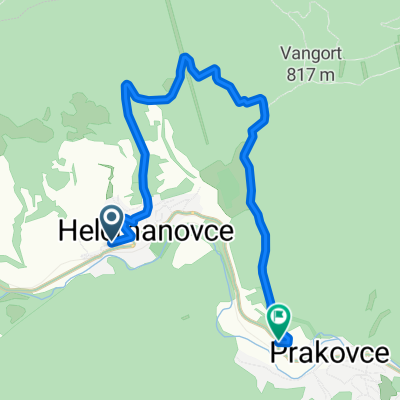
 Prakovce- Polianka- Prakovce
- Distance
- 17.1 km
- Ascent
- 634 m
- Descent
- 634 m
- Location
- Gelnica, Košice Region, Slovakia
 Jakľofski bicigeľ 2016
- Distance
- 30 km
- Ascent
- 927 m
- Descent
- 931 m
- Location
- Gelnica, Košice Region, Slovakia
 Jaklofsky bicigeľ 2014
- Distance
- 25.3 km
- Ascent
- 891 m
- Descent
- 891 m
- Location
- Gelnica, Košice Region, Slovakia
 jaklovce_kurtovaskala_plejsy_thurzov_jaklovce
- Distance
- 27.6 km
- Ascent
- 676 m
- Descent
- 676 m
- Location
- Gelnica, Košice Region, Slovakia
 Helcmanovce-Prakovce (naokolo bližšie :-))
- Distance
- 8.2 km
- Ascent
- 341 m
- Descent
- 337 m
- Location
- Gelnica, Košice Region, Slovakia
 Gelnica-Cechy-Thurzov-Chata Olympia-Helcmanovce
- Distance
- 14.6 km
- Ascent
- 522 m
- Descent
- 731 m
- Location
- Gelnica, Košice Region, Slovakia
 Helcmanovce-"Letisko"-Mníšek nad Hnilcom motocross areál-Helcmanovce
- Distance
- 17.9 km
- Ascent
- 540 m
- Descent
- 542 m
- Location
- Gelnica, Košice Region, Slovakia
Open it in the app