

自然と景観を楽しむ 三橋めぐりコース(行方市)
A cycling route starting in Ishioka, Ibaraki, Japan.
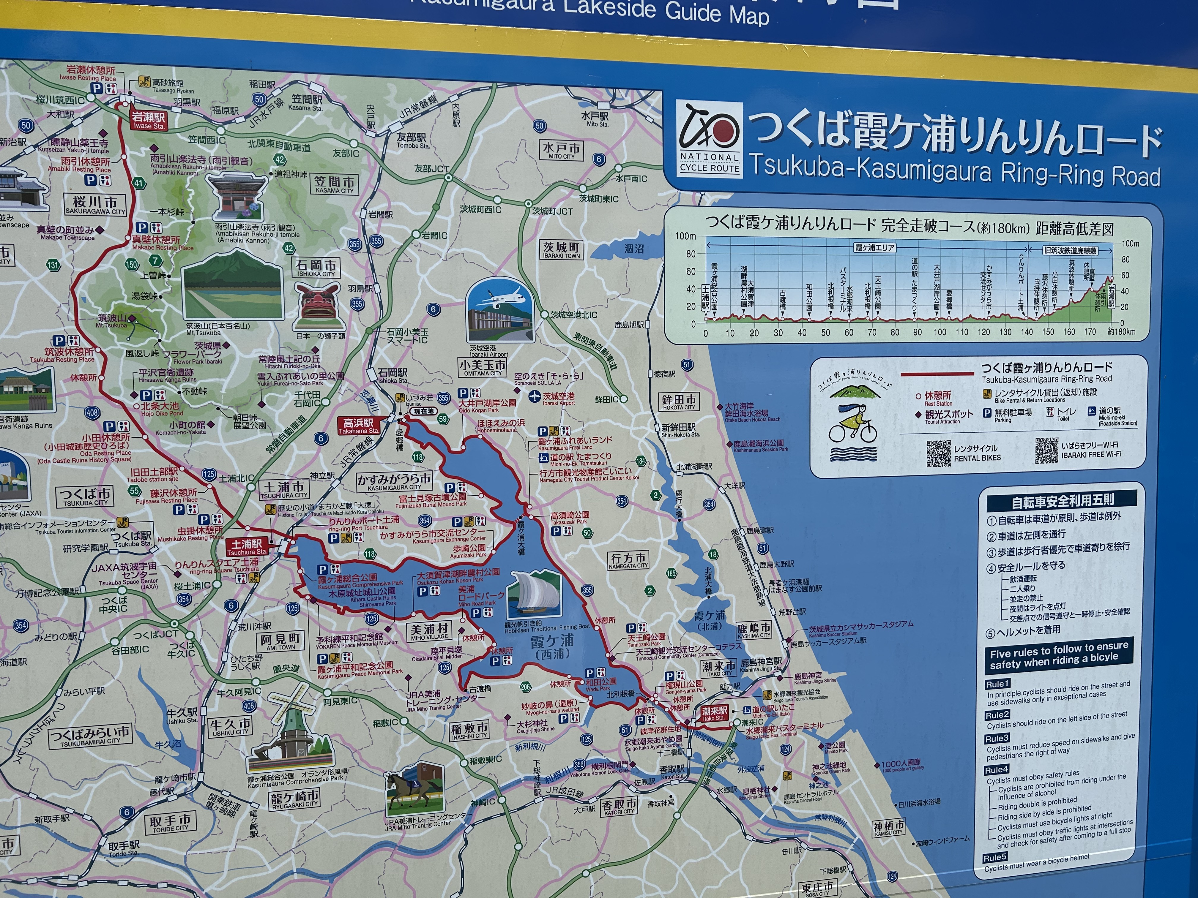
Overview
About this route
- -:--
- Duration
- 28.6 km
- Distance
- 92 m
- Ascent
- 60 m
- Descent
- ---
- Avg. speed
- 36 m
- Max. altitude

Continue with Bikemap
Use, edit, or download this cycling route
You would like to ride 自然と景観を楽しむ 三橋めぐりコース(行方市) or customize it for your own trip? Here is what you can do with this Bikemap route:
Free features
- Save this route as favorite or in collections
- Copy & plan your own version of this route
- Sync your route with Garmin or Wahoo
Premium features
Free trial for 3 days, or one-time payment. More about Bikemap Premium.
- Navigate this route on iOS & Android
- Export a GPX / KML file of this route
- Create your custom printout (try it for free)
- Download this route for offline navigation
Discover more Premium features.
Get Bikemap PremiumFrom our community
Other popular routes starting in Ishioka
 岩坪, かすみがうら市へ岩坪, かすみがうら市
- Distance
- 35.9 km
- Ascent
- 275 m
- Descent
- 272 m
- Location
- Ishioka, Ibaraki, Japan
 獅子頭ライド2023 ロングコース_68.3km 1086mUP
- Distance
- 68.4 km
- Ascent
- 1,192 m
- Descent
- 1,194 m
- Location
- Ishioka, Ibaraki, Japan
 コレぞ、フルーツのまち!ごちそうライドコース
- Distance
- 21.3 km
- Ascent
- 126 m
- Descent
- 128 m
- Location
- Ishioka, Ibaraki, Japan
 【つくいち】メインコース
- Distance
- 107.1 km
- Ascent
- 1,783 m
- Descent
- 1,782 m
- Location
- Ishioka, Ibaraki, Japan
 THK-14
- Distance
- 79.5 km
- Ascent
- 278 m
- Descent
- 237 m
- Location
- Ishioka, Ibaraki, Japan
 武家屋敷と万葉の郷コース
- Distance
- 23.1 km
- Ascent
- 96 m
- Descent
- 97 m
- Location
- Ishioka, Ibaraki, Japan
 川又1965, 石岡市へ川又1965-1, 石岡市
- Distance
- 15 km
- Ascent
- 34 m
- Descent
- 54 m
- Location
- Ishioka, Ibaraki, Japan
 ★2022 つくいち メイン
- Distance
- 105.2 km
- Ascent
- 1,648 m
- Descent
- 1,648 m
- Location
- Ishioka, Ibaraki, Japan
Open it in the app