
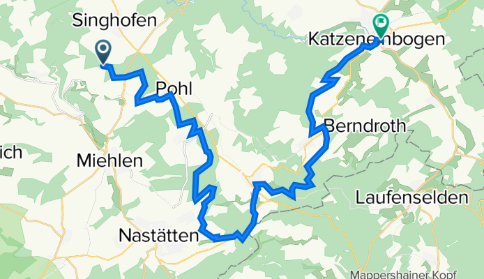
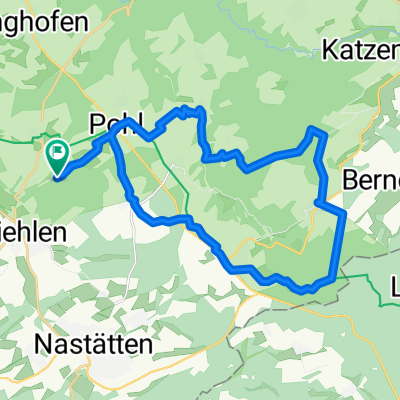
2021-11-21 MTB-Tour Segelflugplatz NASTÄTTEN
A cycling route starting in Hunzel, Rhineland-Palatinate, Germany.
Overview
About this route
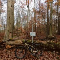
Herrliche Tour mit Start obh. BERG. Dann querfeldein über POHL - BETTENDORF - BUCH hoch zum Segelflugplatz NASTÄTTEN. Oben angekommen dann den herrlichen SOnnenuntergang fotografiert. Zum Schlß dann schnell dunkel geworden.
- -:--
- Duration
- 30.2 km
- Distance
- 670 m
- Ascent
- 718 m
- Descent
- ---
- Avg. speed
- 498 m
- Max. altitude
Route photos


Route quality
Waytypes & surfaces along the route
Waytypes
Track
21.5 km
(71 %)
Quiet road
4.5 km
(15 %)
Surfaces
Paved
9 km
(30 %)
Unpaved
12 km
(40 %)
Gravel
6.8 km
(23 %)
Asphalt
6.7 km
(22 %)
Continue with Bikemap
Use, edit, or download this cycling route
You would like to ride 2021-11-21 MTB-Tour Segelflugplatz NASTÄTTEN or customize it for your own trip? Here is what you can do with this Bikemap route:
Free features
- Save this route as favorite or in collections
- Copy & plan your own version of this route
- Sync your route with Garmin or Wahoo
Premium features
Free trial for 3 days, or one-time payment. More about Bikemap Premium.
- Navigate this route on iOS & Android
- Export a GPX / KML file of this route
- Create your custom printout (try it for free)
- Download this route for offline navigation
Discover more Premium features.
Get Bikemap PremiumFrom our community
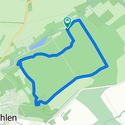
Other popular routes starting in Hunzel
 Radreise zum Hauserbachsee Rückweg (66km/990HM)
- Distance
- 66 km
- Ascent
- 1,564 m
- Descent
- 1,564 m
- Location
- Hunzel, Rhineland-Palatinate, Germany
 2021-11-21 MTB-Tour Segelflugplatz NASTÄTTEN
- Distance
- 30.2 km
- Ascent
- 670 m
- Descent
- 718 m
- Location
- Hunzel, Rhineland-Palatinate, Germany
 Hausebachsee Runde
- Distance
- 25.6 km
- Ascent
- 491 m
- Descent
- 490 m
- Location
- Hunzel, Rhineland-Palatinate, Germany
 Äc?? nach Äc??
- Distance
- 10.2 km
- Ascent
- 154 m
- Descent
- 155 m
- Location
- Hunzel, Rhineland-Palatinate, Germany
 TR-Runde
- Distance
- 5.4 km
- Ascent
- 204 m
- Descent
- 204 m
- Location
- Hunzel, Rhineland-Palatinate, Germany
 Hauserbach Scheuern Mühlbachtal
- Distance
- 34.2 km
- Ascent
- 815 m
- Descent
- 756 m
- Location
- Hunzel, Rhineland-Palatinate, Germany
Open it in the app