Žacléř – Horní Albeřice – Niedamirów (PL) - Žacléř
A cycling route starting in Žacléř, Královéhradecký kraj, Czechia.
Overview
About this route
The shorter circuit through Horní Albeřice leads through beautiful nature and, in good weather, offers interesting views as well as a visit to the Polish border area. From the square in Žacléř, however, it is first necessary to climb to Rýchorský Kříž. After Bouda Hubertus, you will be rewarded with views into the Polish border area with the Bukówka reservoir and the Vraní Mountains. At the intersection near Rýchorský Kříž, you can view a small herd of Scottish Highland cattle and continue above Horní Albeřice. The road runs along the state border, with Sněžka often visible on the left. From the waypoint Nad Horními Albeřicemi, it is just a short distance to the border crossing. Here, you can enjoy a beautiful view of the Sudetes landscape; there's a resting area, a map of the Krkonoš, and informative panels. This route was taken by Protestants during their exile to Poland following the Battle of White Mountain. The next section is a steep descent into the village of Niedamirów. Near the waypoint Parada, Dom trzech kultur, you can view an interesting building of the cultural center, and then ride through a typically agricultural village until you reach the turn-off for the Bobr border crossing, which is already located in the territory of Žacléř. An interesting variant of the trip could be to skip the crossing at Bobr and continue from Niedamirów through Opawa and Szczepanów to Lubawka and return via the Královec border crossing. This would extend the route by an additional 17 km.
Important points: Žacléř – Rýchorský Kříž – border crossing Albeřice, Niedamirów – Niedamirów – border crossing Bobr - Žacléř
- -:--
- Duration
- 16.9 km
- Distance
- 452 m
- Ascent
- 449 m
- Descent
- ---
- Avg. speed
- ---
- Max. altitude
Route highlights
Points of interest along the route
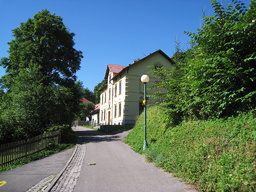
Photo after 7.4 km

Photo after 8.3 km

Photo after 9.2 km

Photo after 9.4 km

Photo after 10.3 km

Photo after 10.3 km

Photo after 11.6 km

Photo after 12.2 km

Photo after 12.4 km
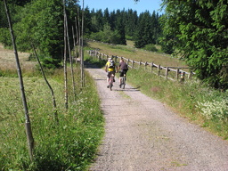
Photo after 12.4 km
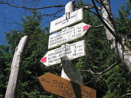
Photo after 12.5 km

Photo after 12.5 km

Photo after 12.5 km

Photo after 12.5 km

Photo after 12.6 km

Photo after 12.6 km

Photo after 12.6 km
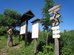
Point of interest after 12.6 km

Photo after 12.6 km

Photo after 12.6 km

Photo after 12.9 km

Photo after 13.4 km

Photo after 13.9 km

Photo after 14 km

Photo after 14.1 km

Photo after 14.4 km

Photo after 15.2 km

Photo after 15.7 km

Photo after 15.8 km
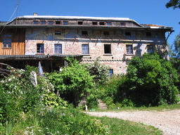
Photo after 16.4 km
Continue with Bikemap
Use, edit, or download this cycling route
You would like to ride Žacléř – Horní Albeřice – Niedamirów (PL) - Žacléř or customize it for your own trip? Here is what you can do with this Bikemap route:
Free features
- Save this route as favorite or in collections
- Copy & plan your own version of this route
- Sync your route with Garmin or Wahoo
Premium features
Free trial for 3 days, or one-time payment. More about Bikemap Premium.
- Navigate this route on iOS & Android
- Export a GPX / KML file of this route
- Create your custom printout (try it for free)
- Download this route for offline navigation
Discover more Premium features.
Get Bikemap PremiumFrom our community
Other popular routes starting in Žacléř
 Žacléř – Horní Albeřice – Niedamirów (PL) - Žacléř
- Distance
- 16.9 km
- Ascent
- 452 m
- Descent
- 449 m
- Location
- Žacléř, Královéhradecký kraj, Czechia
 Mala Upa - Pec a zpět - Elektrokola
- Distance
- 33.3 km
- Ascent
- 990 m
- Descent
- 955 m
- Location
- Žacléř, Královéhradecký kraj, Czechia
 Žacléř-Královec-Trutnov-Žacléř
- Distance
- 35.1 km
- Ascent
- 446 m
- Descent
- 446 m
- Location
- Žacléř, Královéhradecký kraj, Czechia
 Okruh Žacléř – Adršpach – Žacléř
- Distance
- 68.8 km
- Ascent
- 803 m
- Descent
- 797 m
- Location
- Žacléř, Královéhradecký kraj, Czechia
 Žacléř – Stachelberg – Libečská luka - Žacléř
- Distance
- 22.1 km
- Ascent
- 391 m
- Descent
- 391 m
- Location
- Žacléř, Královéhradecký kraj, Czechia
 Žacléř – Prkenný Důl - Rýchory - Žacléř
- Distance
- 16.2 km
- Ascent
- 527 m
- Descent
- 527 m
- Location
- Žacléř, Královéhradecký kraj, Czechia
 Žacléř – Chelmsko Slaskie – Krzeszów - Žacléř
- Distance
- 61.8 km
- Ascent
- 451 m
- Descent
- 454 m
- Location
- Žacléř, Královéhradecký kraj, Czechia
 náměstí Josefa Čapka, Žacléř do Droga bez nazwy
- Distance
- 23.8 km
- Ascent
- 700 m
- Descent
- 379 m
- Location
- Žacléř, Královéhradecký kraj, Czechia
Open it in the app

