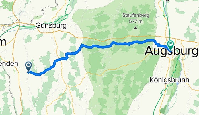
Tour 22 1. Etappe
A cycling route starting in Weißenhorn, Bavaria, Germany.
Overview
About this route
- -:--
- Duration
- 67.9 km
- Distance
- 621 m
- Ascent
- 634 m
- Descent
- ---
- Avg. speed
- 559 m
- Avg. speed
Route quality
Waytypes & surfaces along the route
Waytypes
Road
21.4 km
(32 %)
Path
20.2 km
(30 %)
Surfaces
Paved
59.5 km
(88 %)
Unpaved
0.1 km
(<1 %)
Asphalt
57.2 km
(84 %)
Paved (undefined)
2 km
(3 %)
Continue with Bikemap
Use, edit, or download this cycling route
You would like to ride Tour 22 1. Etappe or customize it for your own trip? Here is what you can do with this Bikemap route:
Free features
- Save this route as favorite or in collections
- Copy & plan your own version of this route
- Sync your route with Garmin or Wahoo
Premium features
Free trial for 3 days, or one-time payment. More about Bikemap Premium.
- Navigate this route on iOS & Android
- Export a GPX / KML file of this route
- Create your custom printout (try it for free)
- Download this route for offline navigation
Discover more Premium features.
Get Bikemap PremiumFrom our community
Other popular routes starting in Weißenhorn
- Trainingsrunde mit kurzen Anstiegen...
- Distance
- 65.6 km
- Ascent
- 435 m
- Descent
- 435 m
- Location
- Weißenhorn, Bavaria, Germany
- Trainingsrunde Leipheim GZ Ichenhausen Krumbach
- Distance
- 73.8 km
- Ascent
- 375 m
- Descent
- 375 m
- Location
- Weißenhorn, Bavaria, Germany
- Vier Täler Weissenhorn-Illertissen
- Distance
- 86.2 km
- Ascent
- 4,856 m
- Descent
- 5,351 m
- Location
- Weißenhorn, Bavaria, Germany
- W-orn Matzenhofen Illertissen W-horn
- Distance
- 41.9 km
- Ascent
- 192 m
- Descent
- 189 m
- Location
- Weißenhorn, Bavaria, Germany
- RTF Thannhausen mit An- und Rückfahrt
- Distance
- 216.5 km
- Ascent
- 2,045 m
- Descent
- 2,027 m
- Location
- Weißenhorn, Bavaria, Germany
- Spitzwegstraße 35, Weißenhorn nach Spitzwegstraße 35, Weißenhorn
- Distance
- 11.9 km
- Ascent
- 106 m
- Descent
- 104 m
- Location
- Weißenhorn, Bavaria, Germany
- Kleine Runde
- Distance
- 30.1 km
- Ascent
- 171 m
- Descent
- 171 m
- Location
- Weißenhorn, Bavaria, Germany
- Schnelle Abendroute
- Distance
- 18.6 km
- Ascent
- 89 m
- Descent
- 89 m
- Location
- Weißenhorn, Bavaria, Germany
Open it in the app