

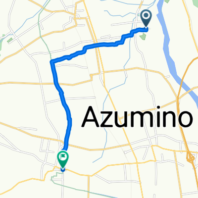
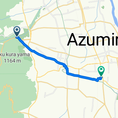
あづみ野やまびこ自転車道
A cycling route starting in Hotaka, Nagano, Japan.
Overview
About this route
- -:--
- Duration
- 14.7 km
- Distance
- 64 m
- Ascent
- 25 m
- Descent
- ---
- Avg. speed
- 573 m
- Max. altitude

Route quality
Waytypes & surfaces along the route
Waytypes
Cycleway
12.3 km
(84 %)
Access road
1.2 km
(8 %)
Continue with Bikemap
Use, edit, or download this cycling route
You would like to ride あづみ野やまびこ自転車道 or customize it for your own trip? Here is what you can do with this Bikemap route:
Free features
- Save this route as favorite or in collections
- Copy & plan your own version of this route
- Sync your route with Garmin or Wahoo
Premium features
Free trial for 3 days, or one-time payment. More about Bikemap Premium.
- Navigate this route on iOS & Android
- Export a GPX / KML file of this route
- Create your custom printout (try it for free)
- Download this route for offline navigation
Discover more Premium features.
Get Bikemap PremiumFrom our community
Other popular routes starting in Hotaka
 安曇野市 大王わさび農園 to ほりかねの里
- Distance
- 8.2 km
- Ascent
- 60 m
- Descent
- 13 m
- Location
- Hotaka, Nagano, Japan
 100kmルート 北アルプス山麓をのんびり楽しむ初中級ルート
- Distance
- 104.1 km
- Ascent
- 1,309 m
- Descent
- 1,310 m
- Location
- Hotaka, Nagano, Japan
 北アルプス山麓をダイナミックに走る上級ルート
- Distance
- 298.8 km
- Ascent
- 10,821 m
- Descent
- 10,823 m
- Location
- Hotaka, Nagano, Japan
 道の駅堀金 から安曇野大王わさび農園
- Distance
- 7.9 km
- Ascent
- 50 m
- Descent
- 5 m
- Location
- Hotaka, Nagano, Japan
 穂高有明7543-61, 安曇野市 to 明科中川手, 安曇野市
- Distance
- 17.7 km
- Ascent
- 541 m
- Descent
- 230 m
- Location
- Hotaka, Nagano, Japan
 堀金烏川, 安曇野市へ豊科本村, 安曇野市
- Distance
- 8.7 km
- Ascent
- 142 m
- Descent
- 284 m
- Location
- Hotaka, Nagano, Japan
 あづみ野やまびこ自転車道
- Distance
- 14.7 km
- Ascent
- 64 m
- Descent
- 25 m
- Location
- Hotaka, Nagano, Japan
 AACR2023_120km
- Distance
- 116 km
- Ascent
- 1,348 m
- Descent
- 1,347 m
- Location
- Hotaka, Nagano, Japan
Open it in the app