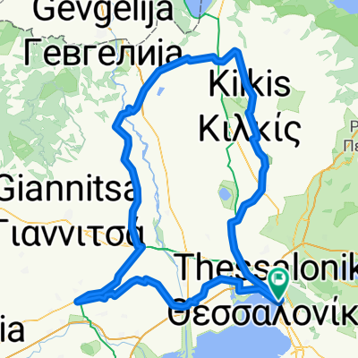
bosnie herzegovina
A cycling route starting in Ágios Pávlos, Central Macedonia, Greece.
Overview
About this route
- -:--
- Duration
- 1,599.8 km
- Distance
- 26,581 m
- Ascent
- 26,617 m
- Descent
- ---
- Avg. speed
- 1,704 m
- Max. altitude
Route quality
Waytypes & surfaces along the route
Waytypes
Quiet road
480 km
(30 %)
Road
192 km
(12 %)
Surfaces
Paved
879.9 km
(55 %)
Unpaved
128 km
(8 %)
Asphalt
847.9 km
(53 %)
Gravel
64 km
(4 %)
Route highlights
Points of interest along the route
Point of interest after 1,170.1 km
visegr
Continue with Bikemap
Use, edit, or download this cycling route
You would like to ride bosnie herzegovina or customize it for your own trip? Here is what you can do with this Bikemap route:
Free features
- Save this route as favorite or in collections
- Copy & plan your own version of this route
- Split it into stages to create a multi-day tour
- Sync your route with Garmin or Wahoo
Premium features
Free trial for 3 days, or one-time payment. More about Bikemap Premium.
- Navigate this route on iOS & Android
- Export a GPX / KML file of this route
- Create your custom printout (try it for free)
- Download this route for offline navigation
Discover more Premium features.
Get Bikemap PremiumFrom our community
Other popular routes starting in Ágios Pávlos
Άγιος Παύλος- Εξοχή- Distance
- 21.1 km
- Ascent
- 557 m
- Descent
- 282 m
- Location
- Ágios Pávlos, Central Macedonia, Greece
Macedonai Basic- Distance
- 569.8 km
- Ascent
- 3,753 m
- Descent
- 3,631 m
- Location
- Ágios Pávlos, Central Macedonia, Greece
Πολύχρωμοι Ποδηλάτες- Distance
- 22.7 km
- Ascent
- 140 m
- Descent
- 150 m
- Location
- Ágios Pávlos, Central Macedonia, Greece
Θεσσαλονίκη-Κατερίνη-Τέμπη- Distance
- 162.5 km
- Ascent
- 462 m
- Descent
- 483 m
- Location
- Ágios Pávlos, Central Macedonia, Greece
Solun - Neos marmaras- Distance
- 157.7 km
- Ascent
- 396 m
- Descent
- 427 m
- Location
- Ágios Pávlos, Central Macedonia, Greece
bosnie herzegovina- Distance
- 1,599.8 km
- Ascent
- 26,581 m
- Descent
- 26,617 m
- Location
- Ágios Pávlos, Central Macedonia, Greece
Thessaloniki-Patras- Distance
- 585.9 km
- Ascent
- 3,163 m
- Descent
- 3,172 m
- Location
- Ágios Pávlos, Central Macedonia, Greece
2007-2.9. Thessaloniki- Asprovalta- Distance
- 87.7 km
- Ascent
- 363 m
- Descent
- 389 m
- Location
- Ágios Pávlos, Central Macedonia, Greece
Open it in the app


