

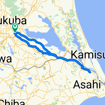
旧筑波鉄道コース
A cycling route starting in Naka, Ibaraki, Japan.
Overview
About this route
- -:--
- Duration
- 40.5 km
- Distance
- 122 m
- Ascent
- 86 m
- Descent
- ---
- Avg. speed
- 60 m
- Max. altitude

Route quality
Waytypes & surfaces along the route
Waytypes
Cycleway
39.3 km
(97 %)
Road
0.4 km
(1 %)
Surfaces
Paved
30.4 km
(75 %)
Asphalt
26.3 km
(65 %)
Paved (undefined)
4.1 km
(10 %)
Undefined
10.1 km
(25 %)
Continue with Bikemap
Use, edit, or download this cycling route
You would like to ride 旧筑波鉄道コース or customize it for your own trip? Here is what you can do with this Bikemap route:
Free features
- Save this route as favorite or in collections
- Copy & plan your own version of this route
- Sync your route with Garmin or Wahoo
Premium features
Free trial for 3 days, or one-time payment. More about Bikemap Premium.
- Navigate this route on iOS & Android
- Export a GPX / KML file of this route
- Create your custom printout (try it for free)
- Download this route for offline navigation
Discover more Premium features.
Get Bikemap PremiumFrom our community
Other popular routes starting in Naka
 Tsuchiura-Rinrin
- Distance
- 37.8 km
- Ascent
- 292 m
- Descent
- 290 m
- Location
- Naka, Ibaraki, Japan
 【茨城県】サイクリングで行く土浦の桜スポット5選&サイクリング魅力ポイント
- Distance
- 31.6 km
- Ascent
- 81 m
- Descent
- 80 m
- Location
- Naka, Ibaraki, Japan
 20160327
- Distance
- 119.5 km
- Ascent
- 118 m
- Descent
- 117 m
- Location
- Naka, Ibaraki, Japan
 20160328
- Distance
- 45.2 km
- Ascent
- 186 m
- Descent
- 188 m
- Location
- Naka, Ibaraki, Japan
 霞ヶ浦一周コース
- Distance
- 128 km
- Ascent
- 37 m
- Descent
- 38 m
- Location
- Naka, Ibaraki, Japan
 aaa-yoyogi
- Distance
- 67.1 km
- Ascent
- 122 m
- Descent
- 114 m
- Location
- Naka, Ibaraki, Japan
 20160402
- Distance
- 121.1 km
- Ascent
- 76 m
- Descent
- 75 m
- Location
- Naka, Ibaraki, Japan
 Tsukuba-Hitachinaka
- Distance
- 65.9 km
- Ascent
- 175 m
- Descent
- 175 m
- Location
- Naka, Ibaraki, Japan
Open it in the app