
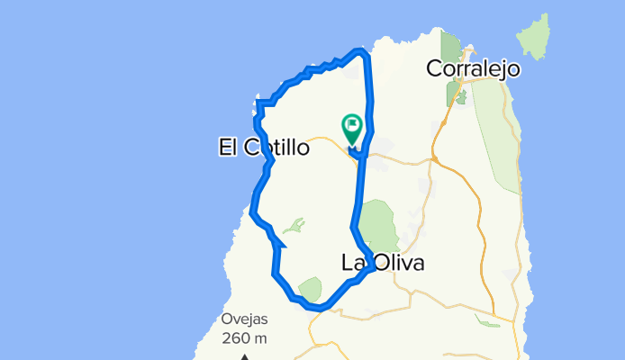
Fuerteventura 2
A cycling route starting in El Cotillo, Canary Islands, Spain.
Overview
About this route
- -:--
- Duration
- 50 km
- Distance
- 403 m
- Ascent
- 403 m
- Descent
- ---
- Avg. speed
- 240 m
- Max. altitude

Route quality
Waytypes & surfaces along the route
Waytypes
Track
22.5 km
(45 %)
Quiet road
10.5 km
(21 %)
Surfaces
Paved
9.5 km
(19 %)
Unpaved
24 km
(48 %)
Gravel
13.5 km
(27 %)
Ground
10.5 km
(21 %)
Continue with Bikemap
Use, edit, or download this cycling route
You would like to ride Fuerteventura 2 or customize it for your own trip? Here is what you can do with this Bikemap route:
Free features
- Save this route as favorite or in collections
- Copy & plan your own version of this route
- Sync your route with Garmin or Wahoo
Premium features
Free trial for 3 days, or one-time payment. More about Bikemap Premium.
- Navigate this route on iOS & Android
- Export a GPX / KML file of this route
- Create your custom printout (try it for free)
- Download this route for offline navigation
Discover more Premium features.
Get Bikemap PremiumFrom our community
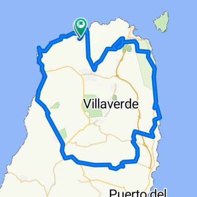
Other popular routes starting in El Cotillo
 Fuerteventura 2
- Distance
- 50 km
- Ascent
- 403 m
- Descent
- 403 m
- Location
- El Cotillo, Canary Islands, Spain
 Betancuria
- Distance
- 125.9 km
- Ascent
- 1,101 m
- Descent
- 1,102 m
- Location
- El Cotillo, Canary Islands, Spain
 green vulcano
- Distance
- 19.9 km
- Ascent
- 342 m
- Descent
- 345 m
- Location
- El Cotillo, Canary Islands, Spain
 Paseo por El Cotillo
- Distance
- 16.1 km
- Ascent
- 249 m
- Descent
- 248 m
- Location
- El Cotillo, Canary Islands, Spain
 RUTA DE PISTA POR NORTE FUERTEVENTURA
- Distance
- 79.2 km
- Ascent
- 576 m
- Descent
- 574 m
- Location
- El Cotillo, Canary Islands, Spain
 Vía Sin Nombre, La Oliva nach ኡርባኒሳሲኦን ኦሪጎ ማሬ, La Oliva
- Distance
- 96.1 km
- Ascent
- 1,341 m
- Descent
- 1,341 m
- Location
- El Cotillo, Canary Islands, Spain
 De Urbanización Hotel Tres Islas 21A, La Oliva a Calle Cardón 40, La Oliva
- Distance
- 6.8 km
- Ascent
- 87 m
- Descent
- 115 m
- Location
- El Cotillo, Canary Islands, Spain
 createTest1
- Distance
- 46.5 km
- Ascent
- 357 m
- Descent
- 363 m
- Location
- El Cotillo, Canary Islands, Spain
Open it in the app