

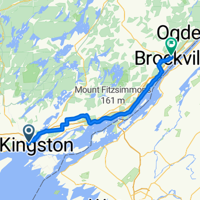
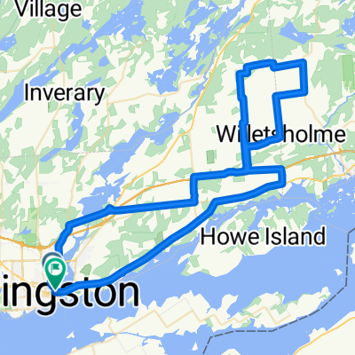
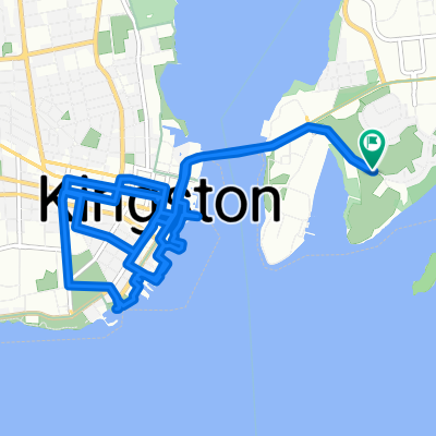
Kingston-Ottawa reverse RLCT (182km)
A cycling route starting in Kingston, Ontario, Canada.
Overview
About this route
- -:--
- Duration
- 182 km
- Distance
- 223 m
- Ascent
- 252 m
- Descent
- ---
- Avg. speed
- ---
- Max. altitude

Route quality
Waytypes & surfaces along the route
Waytypes
Road
32.8 km
(18 %)
Quiet road
32.8 km
(18 %)
Surfaces
Paved
100.1 km
(55 %)
Asphalt
78.3 km
(43 %)
Paved (undefined)
21.8 km
(12 %)
Undefined
81.9 km
(45 %)
Route highlights
Points of interest along the route
Point of interest after 5 km
Long uphill climb up the escarpment here.
Point of interest after 15.6 km
A couple of general stores along this route at the various country road junctions.
Point of interest after 22.6 km
Snacks/drinks at general store.
Point of interest after 42.8 km
Jones Falls is a highly-recommended side trip - short and very scenic. Food/drinks/washrooms available here.
Point of interest after 50.3 km
Food/snacks/drinks available at grocery store in Elgin.
Point of interest after 90.9 km
The gas station at the corner here has snacks/drinks/washroom and is used to seeing lots of cyclists.
Point of interest after 106.2 km
Lots of places to stop for food/drinks/washrooms in Merrickville. My favourite is Brewed Awakenings on the main street.
Point of interest after 155.4 km
Facilities/services in Manotick.
Continue with Bikemap
Use, edit, or download this cycling route
You would like to ride Kingston-Ottawa reverse RLCT (182km) or customize it for your own trip? Here is what you can do with this Bikemap route:
Free features
- Save this route as favorite or in collections
- Copy & plan your own version of this route
- Split it into stages to create a multi-day tour
- Sync your route with Garmin or Wahoo
Premium features
Free trial for 3 days, or one-time payment. More about Bikemap Premium.
- Navigate this route on iOS & Android
- Export a GPX / KML file of this route
- Create your custom printout (try it for free)
- Download this route for offline navigation
Discover more Premium features.
Get Bikemap PremiumFrom our community
Other popular routes starting in Kingston
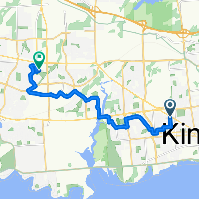
 Princess Street to Magedoma Boulevard
- Distance
- 100.7 km
- Ascent
- 524 m
- Descent
- 526 m
- Location
- Kingston, Ontario, Canada
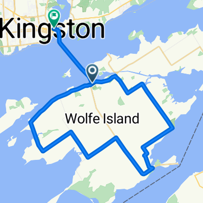 Waterfront Trail (Wolfe Island)
- Distance
- 40.9 km
- Ascent
- 92 m
- Descent
- 96 m
- Location
- Kingston, Ontario, Canada
 bath road water route
- Distance
- 16.2 km
- Ascent
- 78 m
- Descent
- 100 m
- Location
- Kingston, Ontario, Canada
 Kingston - Picton
- Distance
- 69.4 km
- Ascent
- 296 m
- Descent
- 274 m
- Location
- Kingston, Ontario, Canada
 MacDonnell St, Kingston to Gardiners Rd, Kingston
- Distance
- 11.3 km
- Ascent
- 60 m
- Descent
- 65 m
- Location
- Kingston, Ontario, Canada
 Gananoque Airport Loop.
- Distance
- 82.7 km
- Ascent
- 283 m
- Descent
- 279 m
- Location
- Kingston, Ontario, Canada
 Promenade Fort Henry, Kingston à Promenade Fort Henry, Kingston
- Distance
- 13.2 km
- Ascent
- 317 m
- Descent
- 318 m
- Location
- Kingston, Ontario, Canada
 De Road à Leander Street
- Distance
- 39.4 km
- Ascent
- 84 m
- Descent
- 57 m
- Location
- Kingston, Ontario, Canada
Open it in the app