

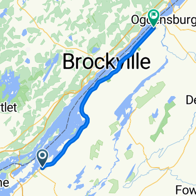
Transit: Ivy Lea - Ottawa
A cycling route starting in Alexandria Bay, New York, United States.
Overview
About this route
This transit route provides a route for cyclists crossing the Ivy Lea international bridge and heading towards Ottawa.
It can also be used an an alternative to the Kingston-Ottawa route by following the Waterfront Trail (Cty Rd 2) from Kingston to Ivy Lea and then taking this route.
Note: Cyclists are not allowed on the international bridge (narrow wide-gauge steel mesh bridge deck) and pedestrian crossings are discouraged (narrow sidewalk close to heavy truck traffic). Best to find a shuttle to take passengers and bikes across.
- -:--
- Duration
- 154.3 km
- Distance
- 175 m
- Ascent
- 195 m
- Descent
- ---
- Avg. speed
- ---
- Max. altitude

Route quality
Waytypes & surfaces along the route
Waytypes
Quiet road
34 km
(22 %)
Road
9.3 km
(6 %)
Surfaces
Paved
109.6 km
(71 %)
Asphalt
86.4 km
(56 %)
Paved (undefined)
23.2 km
(15 %)
Undefined
44.8 km
(29 %)
Continue with Bikemap
Use, edit, or download this cycling route
You would like to ride Transit: Ivy Lea - Ottawa or customize it for your own trip? Here is what you can do with this Bikemap route:
Free features
- Save this route as favorite or in collections
- Copy & plan your own version of this route
- Split it into stages to create a multi-day tour
- Sync your route with Garmin or Wahoo
Premium features
Free trial for 3 days, or one-time payment. More about Bikemap Premium.
- Navigate this route on iOS & Android
- Export a GPX / KML file of this route
- Create your custom printout (try it for free)
- Download this route for offline navigation
Discover more Premium features.
Get Bikemap PremiumFrom our community
Other popular routes starting in Alexandria Bay
 503–505 1000 Islands Pky, Leeds and the Thousand Islands to 24832 Long Point State Park, Three Mile Bay
- Distance
- 83.8 km
- Ascent
- 314 m
- Descent
- 313 m
- Location
- Alexandria Bay, New York, United States
 Alex Bay-Ogden
- Distance
- 52.6 km
- Ascent
- 163 m
- Descent
- 156 m
- Location
- Alexandria Bay, New York, United States
 Transit: Ivy Lea - Ottawa
- Distance
- 154.3 km
- Ascent
- 175 m
- Descent
- 195 m
- Location
- Alexandria Bay, New York, United States
 Waterfront Trail, Leeds et les Mille Îles à 1000 Islands Pky, Leeds et les Mille Îles
- Distance
- 28.3 km
- Ascent
- 129 m
- Descent
- 136 m
- Location
- Alexandria Bay, New York, United States
 Quick Afternoon Ride In Leeds And The Thousand Islands
- Distance
- 0.7 km
- Ascent
- 0 m
- Descent
- 9 m
- Location
- Alexandria Bay, New York, United States
 17 Front St, Leeds and the Thousand Islands to Gananoque
- Distance
- 20.7 km
- Ascent
- 126 m
- Descent
- 118 m
- Location
- Alexandria Bay, New York, United States
 Healy's
- Distance
- 3.4 km
- Ascent
- 35 m
- Descent
- 33 m
- Location
- Alexandria Bay, New York, United States
 Ivy Lea to Ottawa
- Distance
- 155.7 km
- Ascent
- 141 m
- Descent
- 163 m
- Location
- Alexandria Bay, New York, United States
Open it in the app