

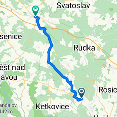
Ketkovice - Dalešice
A cycling route starting in Zbýšov, South Moravian, Czechia.
Overview
About this route
The more information you write here, the more useful it will be for other users.<br /><br />* Route progression.<br />* What is special about this route?<br />* Why recommend this route?<br />* What did you like most here?<br />* Etc.
- -:--
- Duration
- 21.1 km
- Distance
- 305 m
- Ascent
- 337 m
- Descent
- ---
- Avg. speed
- ---
- Max. altitude
Continue with Bikemap
Use, edit, or download this cycling route
You would like to ride Ketkovice - Dalešice or customize it for your own trip? Here is what you can do with this Bikemap route:
Free features
- Save this route as favorite or in collections
- Copy & plan your own version of this route
- Sync your route with Garmin or Wahoo
Premium features
Free trial for 3 days, or one-time payment. More about Bikemap Premium.
- Navigate this route on iOS & Android
- Export a GPX / KML file of this route
- Create your custom printout (try it for free)
- Download this route for offline navigation
Discover more Premium features.
Get Bikemap PremiumFrom our community
Other popular routes starting in Zbýšov
 Zbýšov-Šmelcovna-Bitýška-Veveří-GrandPrix-Zbýšov
- Distance
- 54.1 km
- Ascent
- 619 m
- Descent
- 613 m
- Location
- Zbýšov, South Moravian, Czechia
 Ketkovice - Dalešice
- Distance
- 21.1 km
- Ascent
- 305 m
- Descent
- 337 m
- Location
- Zbýšov, South Moravian, Czechia
 Zakřany do Lánice
- Distance
- 19.4 km
- Ascent
- 270 m
- Descent
- 187 m
- Location
- Zbýšov, South Moravian, Czechia
 Tour de Dukovany
- Distance
- 80.4 km
- Ascent
- 706 m
- Descent
- 706 m
- Location
- Zbýšov, South Moravian, Czechia
 Pohodová rovinka 75km
- Distance
- 75.5 km
- Ascent
- 362 m
- Descent
- 362 m
- Location
- Zbýšov, South Moravian, Czechia
 Zbýšov-Střelice-Zbýšov
- Distance
- 37.8 km
- Ascent
- 545 m
- Descent
- 545 m
- Location
- Zbýšov, South Moravian, Czechia
 Silnička
- Distance
- 62.7 km
- Ascent
- 497 m
- Descent
- 499 m
- Location
- Zbýšov, South Moravian, Czechia
 Silniční 103Km
- Distance
- 102.8 km
- Ascent
- 501 m
- Descent
- 501 m
- Location
- Zbýšov, South Moravian, Czechia
Open it in the app