

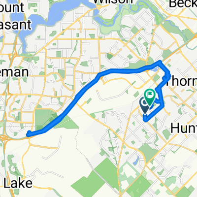
Roe - Fwy - Tokin
A cycling route starting in Canning Vale, Western Australia, Australia.
Overview
About this route
- -:--
- Duration
- 60.8 km
- Distance
- 521 m
- Ascent
- 521 m
- Descent
- ---
- Avg. speed
- 42 m
- Max. altitude

Route quality
Waytypes & surfaces along the route
Waytypes
Cycleway
45 km
(74 %)
Path
13.1 km
(22 %)
Surfaces
Paved
46.4 km
(76 %)
Asphalt
34.4 km
(57 %)
Paved (undefined)
9.3 km
(15 %)
Continue with Bikemap
Use, edit, or download this cycling route
You would like to ride Roe - Fwy - Tokin or customize it for your own trip? Here is what you can do with this Bikemap route:
Free features
- Save this route as favorite or in collections
- Copy & plan your own version of this route
- Sync your route with Garmin or Wahoo
Premium features
Free trial for 3 days, or one-time payment. More about Bikemap Premium.
- Navigate this route on iOS & Android
- Export a GPX / KML file of this route
- Create your custom printout (try it for free)
- Download this route for offline navigation
Discover more Premium features.
Get Bikemap PremiumFrom our community
Other popular routes starting in Canning Vale
 Roe Hwy circuit via freeway Shelley Willeri Dr
- Distance
- 35.5 km
- Ascent
- 106 m
- Descent
- 101 m
- Location
- Canning Vale, Western Australia, Australia
 Restful ride in Canning Vale
- Distance
- 52.2 km
- Ascent
- 200 m
- Descent
- 208 m
- Location
- Canning Vale, Western Australia, Australia
 roe-kwinana-mitchell-reid-tonkin
- Distance
- 79.2 km
- Ascent
- 680 m
- Descent
- 679 m
- Location
- Canning Vale, Western Australia, Australia
 35 Bannister Rd, Canning Vale to 1 Barker Ave, Como
- Distance
- 12.8 km
- Ascent
- 46 m
- Descent
- 49 m
- Location
- Canning Vale, Western Australia, Australia
 Roe - Fwy - Tokin
- Distance
- 60.8 km
- Ascent
- 521 m
- Descent
- 521 m
- Location
- Canning Vale, Western Australia, Australia
 Slow ride in Canning Vale
- Distance
- 28.8 km
- Ascent
- 204 m
- Descent
- 204 m
- Location
- Canning Vale, Western Australia, Australia
 2019-12-09 Champion Lake ride
- Distance
- 31.8 km
- Ascent
- 45 m
- Descent
- 49 m
- Location
- Canning Vale, Western Australia, Australia
 Roe-Belmont-Perth
- Distance
- 61.4 km
- Ascent
- 538 m
- Descent
- 540 m
- Location
- Canning Vale, Western Australia, Australia
Open it in the app