
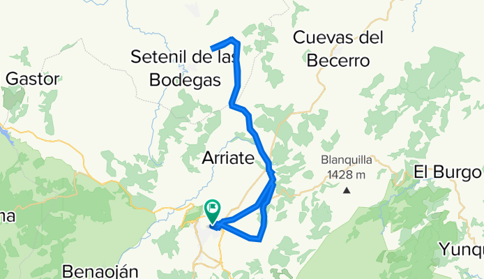
Ruta Setenil
A cycling route starting in Ronda, Andalusia, Spain.
Overview
About this route
- 2 h 45 min
- Duration
- 46.3 km
- Distance
- 508 m
- Ascent
- 501 m
- Descent
- 16.9 km/h
- Avg. speed
- ---
- Max. altitude

Route quality
Waytypes & surfaces along the route
Waytypes
Track
37 km
(80 %)
Quiet road
6.9 km
(15 %)
Surfaces
Paved
5.1 km
(11 %)
Unpaved
37 km
(80 %)
Ground
19.9 km
(43 %)
Gravel
16.7 km
(36 %)
Continue with Bikemap
Use, edit, or download this cycling route
You would like to ride Ruta Setenil or customize it for your own trip? Here is what you can do with this Bikemap route:
Free features
- Save this route as favorite or in collections
- Copy & plan your own version of this route
- Sync your route with Garmin or Wahoo
Premium features
Free trial for 3 days, or one-time payment. More about Bikemap Premium.
- Navigate this route on iOS & Android
- Export a GPX / KML file of this route
- Create your custom printout (try it for free)
- Download this route for offline navigation
Discover more Premium features.
Get Bikemap PremiumFrom our community
Other popular routes starting in Ronda
 Azento - Dag 4
- Distance
- 54.2 km
- Ascent
- 726 m
- Descent
- 1,433 m
- Location
- Ronda, Andalusia, Spain
 Ronda-Grazalema-Zahara-Ronda
- Distance
- 83 km
- Ascent
- 1,470 m
- Descent
- 1,469 m
- Location
- Ronda, Andalusia, Spain
 Ruta Setenil
- Distance
- 46.3 km
- Ascent
- 508 m
- Descent
- 501 m
- Location
- Ronda, Andalusia, Spain
 101 Km Ronda 2008-GR163
- Distance
- 102.7 km
- Ascent
- 1,395 m
- Descent
- 1,395 m
- Location
- Ronda, Andalusia, Spain
 Prueba Pilar de Coca
- Distance
- 16.4 km
- Ascent
- 154 m
- Descent
- 152 m
- Location
- Ronda, Andalusia, Spain
 Serrato
- Distance
- 69.7 km
- Ascent
- 1,209 m
- Descent
- 1,206 m
- Location
- Ronda, Andalusia, Spain
 Ronda MTB 40km
- Distance
- 38.2 km
- Ascent
- 497 m
- Descent
- 496 m
- Location
- Ronda, Andalusia, Spain
 Ronda-Setenil
- Distance
- 64.3 km
- Ascent
- 843 m
- Descent
- 839 m
- Location
- Ronda, Andalusia, Spain
Open it in the app