

Normandy 44
A cycling route starting in Carentan, Normandy, France.
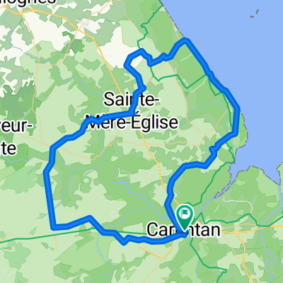
Overview
About this route
Portsmouth Le Havre boat, then train to Caen may be best connection
- -:--
- Duration
- 204.1 km
- Distance
- 1,075 m
- Ascent
- 1,032 m
- Descent
- ---
- Avg. speed
- 118 m
- Max. altitude

Route quality
Waytypes & surfaces along the route
Waytypes
Quiet road
65.3 km
(32 %)
Road
53.1 km
(26 %)
Surfaces
Paved
112.3 km
(55 %)
Unpaved
24.5 km
(12 %)
Asphalt
112.3 km
(55 %)
Gravel
12.2 km
(6 %)
Route highlights
Points of interest along the route
Point of interest after 0 km
UTAH
Point of interest after 0.2 km
St Mere Eglise
Point of interest after 0.6 km
Battle of Causeway at La Fiere
Point of interest after 2.3 km
Museum
Point of interest after 3.8 km
Bloody Gulch battlefield
Point of interest after 3.8 km
Bloody Gulch memorial
Point of interest after 26.8 km
German Cemetery
Point of interest after 33.5 km
Maisy Battery
Point of interest after 40.4 km
Pointe du Hoc
Point of interest after 48.9 km
WN73
Point of interest after 52.2 km
OMAHA
Point of interest after 53.9 km
WN 65
Point of interest after 54.5 km
US cemetery
Point of interest after 55.4 km
WN62
Point of interest after 55.6 km
WN 61
Point of interest after 57.3 km
Museum
Point of interest after 59.7 km
WN 61
Point of interest after 74.4 km
Longues Battery
Point of interest after 90.2 km
GOLD
Point of interest after 103.4 km
JUNO
Point of interest after 110.5 km
Hilman
Point of interest after 112 km
SWORD
Point of interest after 128.3 km
Merville Battery
Point of interest after 138 km
Pegasus Bridge
Point of interest after 145.7 km
Ken Touts Troop
Point of interest after 145.9 km
Wittmans Tiger
Point of interest after 153.4 km
Abbey
Point of interest after 158.1 km
7th June Battlefield
Point of interest after 168.9 km
Hill 112
Continue with Bikemap
Use, edit, or download this cycling route
You would like to ride Normandy 44 or customize it for your own trip? Here is what you can do with this Bikemap route:
Free features
- Save this route as favorite or in collections
- Copy & plan your own version of this route
- Split it into stages to create a multi-day tour
- Sync your route with Garmin or Wahoo
Premium features
Free trial for 3 days, or one-time payment. More about Bikemap Premium.
- Navigate this route on iOS & Android
- Export a GPX / KML file of this route
- Create your custom printout (try it for free)
- Download this route for offline navigation
Discover more Premium features.
Get Bikemap PremiumFrom our community
Other popular routes starting in Carentan
 tandemXeurope 2009 - Day 5
- Distance
- 91.5 km
- Ascent
- 254 m
- Descent
- 253 m
- Location
- Carentan, Normandy, France
 Normandy 44
- Distance
- 204.1 km
- Ascent
- 1,075 m
- Descent
- 1,032 m
- Location
- Carentan, Normandy, France
 From Carentan-les-Marais to Port-en-Bessin-Huppain
- Distance
- 53.6 km
- Ascent
- 312 m
- Descent
- 267 m
- Location
- Carentan, Normandy, France
 24 maggio
- Distance
- 89.4 km
- Ascent
- 903 m
- Descent
- 787 m
- Location
- Carentan, Normandy, France
 NORMANDY DAY 2 28 AUG 2014
- Distance
- 87.6 km
- Ascent
- 253 m
- Descent
- 257 m
- Location
- Carentan, Normandy, France
 Normandie 4 - Carentan-Rundfahrt
- Distance
- 74.6 km
- Ascent
- 185 m
- Descent
- 185 m
- Location
- Carentan, Normandy, France
 Angoville (Domaine) - Cherbourg
- Distance
- 79.8 km
- Ascent
- 243 m
- Descent
- 253 m
- Location
- Carentan, Normandy, France
 Route Américaine, Carentan-les-Marais to Rue de la Hérode, Vierville-sur-Mer
- Distance
- 44.9 km
- Ascent
- 198 m
- Descent
- 168 m
- Location
- Carentan, Normandy, France
Open it in the app