

Butterfly World Trail
A cycling route starting in Coconut Creek, Florida, United States of America.
Overview
About this route
Start out at Butterfly World and leisurely wind your way through Tradewinds Park, including the horse stables. Pass by Monarch High School on your way to Sabal Pines Park.
If the loop is a bit too long you can easily take some shortcuts to reduce the length.
This route has only one major road crossing each way.
When you return to Butterfly World head inside, cool off, and investigate this unique destination. :)
- -:--
- Duration
- 34.6 km
- Distance
- 72 m
- Ascent
- 70 m
- Descent
- ---
- Avg. speed
- 14 m
- Max. altitude
Route quality
Waytypes & surfaces along the route
Waytypes
Access road
17.6 km
(51 %)
Quiet road
13.1 km
(38 %)
Surfaces
Paved
4.4 km
(13 %)
Asphalt
4.4 km
(13 %)
Undefined
30.2 km
(87 %)
Route highlights
Points of interest along the route
Point of interest after 4.9 km
Horse stables.
Continue with Bikemap
Use, edit, or download this cycling route
You would like to ride Butterfly World Trail or customize it for your own trip? Here is what you can do with this Bikemap route:
Free features
- Save this route as favorite or in collections
- Copy & plan your own version of this route
- Sync your route with Garmin or Wahoo
Premium features
Free trial for 3 days, or one-time payment. More about Bikemap Premium.
- Navigate this route on iOS & Android
- Export a GPX / KML file of this route
- Create your custom printout (try it for free)
- Download this route for offline navigation
Discover more Premium features.
Get Bikemap PremiumFrom our community
Other popular routes starting in Coconut Creek
 Coconut Creek a Coconut Creek
- Distance
- 5.6 km
- Ascent
- 6 m
- Descent
- 0 m
- Location
- Coconut Creek, Florida, United States of America
 5005 NW 39th Ave, Coconut Creek to 5005 NW 39th Ave, Coconut Creek
- Distance
- 11.5 km
- Ascent
- 0 m
- Descent
- 4 m
- Location
- Coconut Creek, Florida, United States of America
 West Atlantic Boulevard 3559, Pompano Beach to West Atlantic Boulevard 3559, Pompano Beach
- Distance
- 5 km
- Ascent
- 5 m
- Descent
- 2 m
- Location
- Coconut Creek, Florida, United States of America
 North Palm Aire Drive 2601, Pompano Beach to North Palm Aire Drive 2601, Pompano Beach
- Distance
- 37.3 km
- Ascent
- 34 m
- Descent
- 36 m
- Location
- Coconut Creek, Florida, United States of America
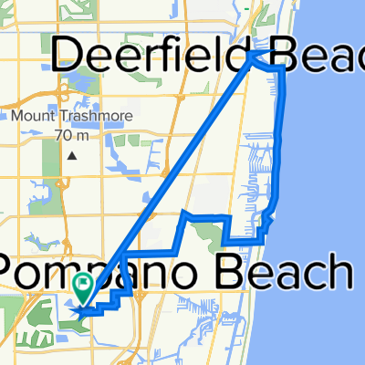
 Butterfly World Trail
- Distance
- 34.6 km
- Ascent
- 72 m
- Descent
- 70 m
- Location
- Coconut Creek, Florida, United States of America
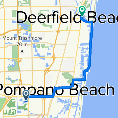 North Palm Aire Drive 2601, Pompano Beach to North Federal Highway 142, Deerfield Beach
- Distance
- 18.9 km
- Ascent
- 14 m
- Descent
- 18 m
- Location
- Coconut Creek, Florida, United States of America
 2902–2926 N Course Dr, Pompano Beach to 6250 NW 27th Way, Fort Lauderdale
- Distance
- 4.7 km
- Ascent
- 0 m
- Descent
- 0 m
- Location
- Coconut Creek, Florida, United States of America
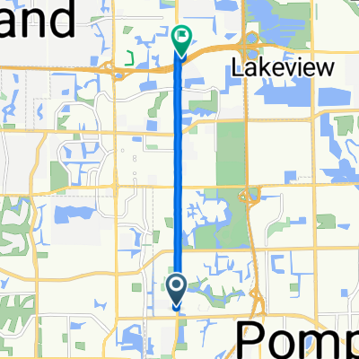 1399 Lyons Rd, Coconut Creek to 4579 NW 60th Ct, Coconut Creek
- Distance
- 6.8 km
- Ascent
- 19 m
- Descent
- 17 m
- Location
- Coconut Creek, Florida, United States of America
Open it in the app