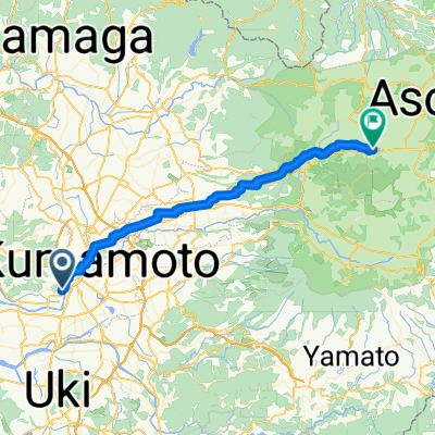
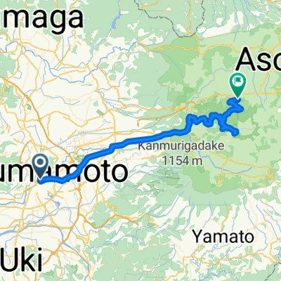
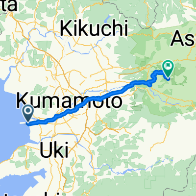
Kumamoto Mountain Tour
A cycling route starting in Kumamoto, Kumamoto, Japan.
Overview
About this route
Tour starts easy and flat. It goes through a nice valley. Soon it has a short steep climb and continues with a longer climb in beautiful nature. Tour finishes with another short steep climb followed by a small mountain and then going downhill.
- -:--
- Duration
- 47.1 km
- Distance
- 683 m
- Ascent
- 683 m
- Descent
- ---
- Avg. speed
- ---
- Max. altitude
Route quality
Waytypes & surfaces along the route
Waytypes
Busy road
17 km
(36 %)
Road
14 km
(30 %)
Surfaces
Paved
7.3 km
(16 %)
Paved (undefined)
7.3 km
(16 %)
Undefined
39.7 km
(84 %)
Continue with Bikemap
Use, edit, or download this cycling route
You would like to ride Kumamoto Mountain Tour or customize it for your own trip? Here is what you can do with this Bikemap route:
Free features
- Save this route as favorite or in collections
- Copy & plan your own version of this route
- Sync your route with Garmin or Wahoo
Premium features
Free trial for 3 days, or one-time payment. More about Bikemap Premium.
- Navigate this route on iOS & Android
- Export a GPX / KML file of this route
- Create your custom printout (try it for free)
- Download this route for offline navigation
Discover more Premium features.
Get Bikemap PremiumFrom our community
Other popular routes starting in Kumamoto
- kyushu day4
- Distance
- 54.4 km
- Ascent
- 125 m
- Descent
- 138 m
- Location
- Kumamoto, Kumamoto, Japan
- Kumamoto Mountain Tour (Tawara-yama)
- Distance
- 105.1 km
- Ascent
- 1,396 m
- Descent
- 1,396 m
- Location
- Kumamoto, Kumamoto, Japan
- Kumamoto Mountain Tour
- Distance
- 47.1 km
- Ascent
- 683 m
- Descent
- 683 m
- Location
- Kumamoto, Kumamoto, Japan
- Day 524
- Distance
- 38.5 km
- Ascent
- 478 m
- Descent
- 100 m
- Location
- Kumamoto, Kumamoto, Japan
- 西区在住・赤星俊光選手推薦コース
- Distance
- 36.6 km
- Ascent
- 0 m
- Descent
- 0 m
- Location
- Kumamoto, Kumamoto, Japan
- Day 527
- Distance
- 4.9 km
- Ascent
- 3 m
- Descent
- 11 m
- Location
- Kumamoto, Kumamoto, Japan
- 9-39, Jozanhanta 2-Chōme, Nishi, Kumamoto to 1963-2, Sakamoto, Misato, Shimomashiki-Gun
- Distance
- 35.9 km
- Ascent
- 442 m
- Descent
- 188 m
- Location
- Kumamoto, Kumamoto, Japan
- 5, Kumamoto to 1497-10, Aso
- Distance
- 51.1 km
- Ascent
- 1,232 m
- Descent
- 743 m
- Location
- Kumamoto, Kumamoto, Japan
Open it in the app