

Tappa 2 Cerignola - Canosa
A cycling route starting in Lavello, Basilicate, Italy.
Overview
About this route
- -:--
- Duration
- 24.7 km
- Distance
- 147 m
- Ascent
- 201 m
- Descent
- ---
- Avg. speed
- 183 m
- Max. altitude

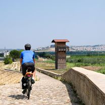
Route photos

Route quality
Waytypes & surfaces along the route
Waytypes
Quiet road
10.8 km
(44 %)
Road
5.8 km
(24 %)
Surfaces
Paved
8.6 km
(35 %)
Unpaved
1.8 km
(7 %)
Asphalt
5.4 km
(22 %)
Paved (undefined)
3.2 km
(13 %)
Route highlights
Points of interest along the route
Point of interest after 6.9 km
Forte salita
Photo after 10.9 km
Ripalta
Point of interest after 23.1 km
Ponte Romano della Via Traiana sull'Ofanto
Continue with Bikemap
Use, edit, or download this cycling route
You would like to ride Tappa 2 Cerignola - Canosa or customize it for your own trip? Here is what you can do with this Bikemap route:
Free features
- Save this route as favorite or in collections
- Copy & plan your own version of this route
- Sync your route with Garmin or Wahoo
Premium features
Free trial for 3 days, or one-time payment. More about Bikemap Premium.
- Navigate this route on iOS & Android
- Export a GPX / KML file of this route
- Create your custom printout (try it for free)
- Download this route for offline navigation
Discover more Premium features.
Get Bikemap PremiumFrom our community
Other popular routes starting in Lavello
 Lavello-Maschito-Forenza-Acerenza-Oppido-Genzano-Maschito-Venosa-Lavello
- Distance
- 151.2 km
- Ascent
- 1,836 m
- Descent
- 1,834 m
- Location
- Lavello, Basilicate, Italy
 La Via del Grano
- Distance
- 35.5 km
- Ascent
- 230 m
- Descent
- 401 m
- Location
- Lavello, Basilicate, Italy
 Tappa 2 Cerignola - Canosa
- Distance
- 24.7 km
- Ascent
- 147 m
- Descent
- 201 m
- Location
- Lavello, Basilicate, Italy
 LAvello-Palazzo (Via Pantano Venosa)-Forenza-Lavello
- Distance
- 93.2 km
- Ascent
- 1,011 m
- Descent
- 1,026 m
- Location
- Lavello, Basilicate, Italy
 Lavello - Rifugio Vulture - Monticchio - Pisciolo
- Distance
- 131.8 km
- Ascent
- 2,351 m
- Descent
- 2,350 m
- Location
- Lavello, Basilicate, Italy
 Lavello-Rionero-Forenza-Genzano-Palazzo-Venosa-Lavello
- Distance
- 140.1 km
- Ascent
- 1,601 m
- Descent
- 1,613 m
- Location
- Lavello, Basilicate, Italy
 Lavello-Barile-Ginestra-Ripacandida-Rionero-Monticchio-Monteverde-Melfi-Rapolla- Pian del cerro - Lavello
- Distance
- 126.9 km
- Ascent
- 2,058 m
- Descent
- 2,058 m
- Location
- Lavello, Basilicate, Italy
 Lavello-Rifugio Vulture (CHALET) - Monte Carmine - Lavello
- Distance
- 127.1 km
- Ascent
- 2,174 m
- Descent
- 2,172 m
- Location
- Lavello, Basilicate, Italy
Open it in the app