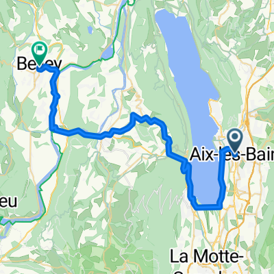
3 - Aux-Les-Bains to Talloires - Backup 1
A cycling route starting in Aix-les-Bains, Auvergne-Rh么ne-Alpes, France.
Overview
About this route
No major hills - long 100k route around the outside of the national park
Startinng - Hotel Des Eaux - Aix-les-Bains
Finishing - Hotel Beau, Talloires
- -:--
- Duration
- 107.2 km
- Distance
- 867 m
- Ascent
- 678 m
- Descent
- ---
- Avg. speed
- 506 m
- Avg. speed
Route quality
Waytypes & surfaces along the route
Waytypes
Cycleway
49.5 km
(46 %)
Busy road
27.1 km
(25 %)
Surfaces
Paved
77.9 km
(73 %)
Unpaved
1.9 km
(2 %)
Asphalt
77.3 km
(72 %)
Gravel
1 km
(<1 %)
Continue with Bikemap
Use, edit, or download this cycling route
You would like to ride 3 - Aux-Les-Bains to Talloires - Backup 1 or customize it for your own trip? Here is what you can do with this Bikemap route:
Free features
- Save this route as favorite or in collections
- Copy & plan your own version of this route
- Sync your route with Garmin or Wahoo
Premium features
Free trial for 3 days, or one-time payment. More about Bikemap Premium.
- Navigate this route on iOS & Android
- Export a GPX / KML file of this route
- Create your custom printout (try it for free)
- Download this route for offline navigation
Discover more Premium features.
Get Bikemap PremiumFrom our community
Other popular routes starting in Aix-les-Bains
- De Rue du Maroc 85, Aix-les-Bains 脿 Chemin la Tessonni猫re d'en Bas 117, La Motte-Servolex
- Distance
- 14.3 km
- Ascent
- 154 m
- Descent
- 120 m
- Location
- Aix-les-Bains, Auvergne-Rh么ne-Alpes, France
- 3 - Aux-Les-Bains to Talloires - Backup 1
- Distance
- 107.2 km
- Ascent
- 867 m
- Descent
- 678 m
- Location
- Aix-les-Bains, Auvergne-Rh么ne-Alpes, France
- Pyenees to the Alps day 6 a
- Distance
- 85.6 km
- Ascent
- 690 m
- Descent
- 564 m
- Location
- Aix-les-Bains, Auvergne-Rh么ne-Alpes, France
- Mont Revard 1537 m聽
- Distance
- 21 km
- Ascent
- 1,267 m
- Descent
- 35 m
- Location
- Aix-les-Bains, Auvergne-Rh么ne-Alpes, France
- Aix Les Bains
- Distance
- 54.3 km
- Ascent
- 881 m
- Descent
- 827 m
- Location
- Aix-les-Bains, Auvergne-Rh么ne-Alpes, France
- droga z Aix-les-Bains do Grenoble
- Distance
- 78.6 km
- Ascent
- 399 m
- Descent
- 429 m
- Location
- Aix-les-Bains, Auvergne-Rh么ne-Alpes, France
- Untitled route
- Distance
- 75.1 km
- Ascent
- 369 m
- Descent
- 294 m
- Location
- Aix-les-Bains, Auvergne-Rh么ne-Alpes, France
- Aix-les-Bains Mont Revard
- Distance
- 20.4 km
- Ascent
- 1,320 m
- Descent
- 133 m
- Location
- Aix-les-Bains, Auvergne-Rh么ne-Alpes, France
Open it in the app