

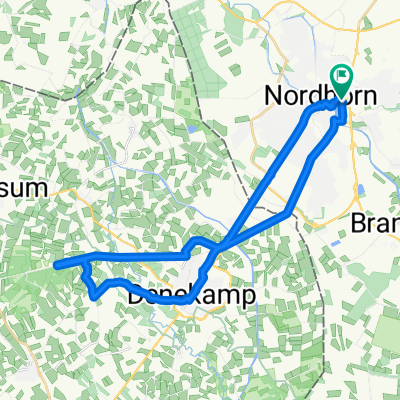
Nordhorn-Bad Bentheim
A cycling route starting in Nordhorn, Lower Saxony, Germany.
Overview
About this route
Nordhorn, Frensdorfer Ring (P+R)
Bad Bentheim
Grafschafter Stube, ab 11 Uhr kein Ruhetag
Tonino, 12-14 Uhr, kein Ruhetag
Zapata, Montag - Freitag: ab 14:00 Samstag + Sonntag ab 12 Uhr kein Ruhetag
- -:--
- Duration
- 77.9 km
- Distance
- 302 m
- Ascent
- 304 m
- Descent
- ---
- Avg. speed
- 82 m
- Max. altitude

Route quality
Waytypes & surfaces along the route
Waytypes
Quiet road
39.1 km
(50 %)
Path
15.5 km
(20 %)
Surfaces
Paved
59 km
(76 %)
Unpaved
8.6 km
(11 %)
Asphalt
34.9 km
(45 %)
Paved (undefined)
10.9 km
(14 %)
Route highlights
Points of interest along the route
Accommodation after 32 km
Zapata
Accommodation after 32.3 km
Grafschafter Stube
Accommodation after 33.1 km
Ristorante Tonino
Continue with Bikemap
Use, edit, or download this cycling route
You would like to ride Nordhorn-Bad Bentheim or customize it for your own trip? Here is what you can do with this Bikemap route:
Free features
- Save this route as favorite or in collections
- Copy & plan your own version of this route
- Sync your route with Garmin or Wahoo
Premium features
Free trial for 3 days, or one-time payment. More about Bikemap Premium.
- Navigate this route on iOS & Android
- Export a GPX / KML file of this route
- Create your custom printout (try it for free)
- Download this route for offline navigation
Discover more Premium features.
Get Bikemap PremiumFrom our community
Other popular routes starting in Nordhorn
 20170623_091808.gpx
- Distance
- 27.1 km
- Ascent
- 44 m
- Descent
- 43 m
- Location
- Nordhorn, Lower Saxony, Germany
 Riverside-Denekamp-Hunebrug-Riverside
- Distance
- 29.2 km
- Ascent
- 49 m
- Descent
- 46 m
- Location
- Nordhorn, Lower Saxony, Germany
 Nordhorn - Bookholt - Stadtflur - Klausheide - Flugplatz- Vechtesee
- Distance
- 30.4 km
- Ascent
- 29 m
- Descent
- 27 m
- Location
- Nordhorn, Lower Saxony, Germany
 1. Versuch 13,56 in 43 min
- Distance
- 13.6 km
- Ascent
- 181 m
- Descent
- 193 m
- Location
- Nordhorn, Lower Saxony, Germany
 NOH-Grenz- Dinkel-Lage, Frenzwegen-NOH
- Distance
- 34 km
- Ascent
- 30 m
- Descent
- 26 m
- Location
- Nordhorn, Lower Saxony, Germany
 Neubürgerroute 1
- Distance
- 17.9 km
- Ascent
- 22 m
- Descent
- 22 m
- Location
- Nordhorn, Lower Saxony, Germany
 20170623_091808.gpx
- Distance
- 27.1 km
- Ascent
- 28 m
- Descent
- 26 m
- Location
- Nordhorn, Lower Saxony, Germany
 Nordhorn-Bad Bentheim
- Distance
- 77.9 km
- Ascent
- 302 m
- Descent
- 304 m
- Location
- Nordhorn, Lower Saxony, Germany
Open it in the app