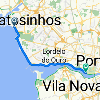
Route from Porto
- 86.2 km
- 2,482 m
- 2,419 m
- Matosinhos Municipality, Porto District, Portugal
A cycling route starting in Matosinhos Municipality, Porto District, Portugal.
Overview
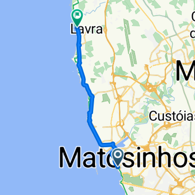
The race starts and ends at the crowded beach of Matosinhos near some of the best know fish canneries from the region and heads north up to Vila do Conde.
Around 30 km of coastal roads that will be a good opportunity for BAs to be formed since the Atlantic winds blows right towards the riders' faces.
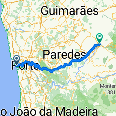
After reaching Vila do Conde, the riders turn inland towards Trofa. From there, they start racing south passing the small Monte Santo Oviedo, Maia, Ermesinde, Rio Tinto and down to Gondomar near the Rio Douro. This will be the bumpier part of the route, but the inclines are so small and with still 30 kms to go, it will be hard for the puncheurs to make any surprises.
The race now heads into its final part. To avoid the crowded Porto's City Centre, the riders cross São Mamede de Infesta, Leça do Balio, Santa Cruz do Bispo and Guifões. Being the suburbs from a big city, the roads are not wide nor have easy turns, so positioning will be very hard.
After Guifões, on the final 7 kms the riders head down back into Matosinhos. The organizers tried they best to pass alongside all of the major landmarks of the city (mainly fish canneries) and thus made the final part very complicated. On the final 3 kms we have 11 90° turns and 1 roundabout. The last of this turn sits just 200 meters away from the fishing line... erm sorry, the finishing line.
Positioning and a good technique will be vital to win the race.
created this 3 years ago
Route quality
Quiet road
46 km
(37 %)
Road
27.4 km
(22 %)
Paved
59.7 km
(48 %)
Unpaved
1.2 km
(1 %)
Asphalt
56 km
(45 %)
Paved (undefined)
1.2 km
(1 %)
Continue with Bikemap
You would like to ride Taça Conservas de Matosinhos or customize it for your own trip? Here is what you can do with this Bikemap route:
Free trial for 3 days, or one-time payment. More about Bikemap Premium.
Discover more Premium features.
Get Bikemap PremiumFrom our community
Open it in the app