
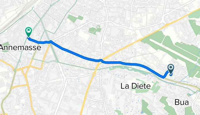
65 Route de Taninges, Vétraz-Monthoux à Rue du Faucigny, Annemasse
A cycling route starting in Vétraz-Monthoux, Auvergne-Rhône-Alpes, France.
Overview
About this route
- 9 min
- Duration
- 2.5 km
- Distance
- 0 m
- Ascent
- 49 m
- Descent
- 17.3 km/h
- Avg. speed
- 488 m
- Max. altitude
Route quality
Waytypes & surfaces along the route
Waytypes
Busy road
1.4 km
(57 %)
Quiet road
0.6 km
(24 %)
Surfaces
Paved
2.3 km
(92 %)
Asphalt
2.3 km
(92 %)
Undefined
0.2 km
(8 %)
Continue with Bikemap
Use, edit, or download this cycling route
You would like to ride 65 Route de Taninges, Vétraz-Monthoux à Rue du Faucigny, Annemasse or customize it for your own trip? Here is what you can do with this Bikemap route:
Free features
- Save this route as favorite or in collections
- Copy & plan your own version of this route
- Sync your route with Garmin or Wahoo
Premium features
Free trial for 3 days, or one-time payment. More about Bikemap Premium.
- Navigate this route on iOS & Android
- Export a GPX / KML file of this route
- Create your custom printout (try it for free)
- Download this route for offline navigation
Discover more Premium features.
Get Bikemap PremiumFrom our community
Other popular routes starting in Vétraz-Monthoux
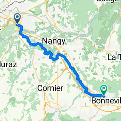 Annemasse - Bonneville
- Distance
- 22.6 km
- Ascent
- 161 m
- Descent
- 122 m
- Location
- Vétraz-Monthoux, Auvergne-Rhône-Alpes, France
 EDT 2023 - DRP10 - sans Saxel/Cou/Feu/pied Ramaz
- Distance
- 107.9 km
- Ascent
- 3,002 m
- Descent
- 2,476 m
- Location
- Vétraz-Monthoux, Auvergne-Rhône-Alpes, France
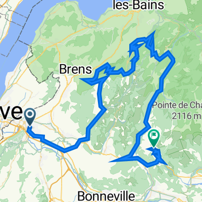 EDT 2023 : 4eme tronçon Saxel + Cou + Feu + pied Ramaz
- Distance
- 97.9 km
- Ascent
- 2,619 m
- Descent
- 2,157 m
- Location
- Vétraz-Monthoux, Auvergne-Rhône-Alpes, France
 EDT 2023 - DRP7 - sans Feu
- Distance
- 139.6 km
- Ascent
- 3,963 m
- Descent
- 3,437 m
- Location
- Vétraz-Monthoux, Auvergne-Rhône-Alpes, France
 EDT 2023 - DRP8 - jambaz -ramaz directe
- Distance
- 142.3 km
- Ascent
- 4,213 m
- Descent
- 3,687 m
- Location
- Vétraz-Monthoux, Auvergne-Rhône-Alpes, France
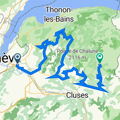
 EDT 2023 : 3eme tronçon b Saxel - Cou - Feu - pied Ramaz
- Distance
- 47 km
- Ascent
- 963 m
- Descent
- 493 m
- Location
- Vétraz-Monthoux, Auvergne-Rhône-Alpes, France
 EDT 2023 - DRP9 - sans Feu / pied ramaz
- Distance
- 124.9 km
- Ascent
- 3,612 m
- Descent
- 3,087 m
- Location
- Vétraz-Monthoux, Auvergne-Rhône-Alpes, France
 EDT 2023 - officiel
- Distance
- 158.1 km
- Ascent
- 4,585 m
- Descent
- 4,058 m
- Location
- Vétraz-Monthoux, Auvergne-Rhône-Alpes, France
Open it in the app