

R10 Lavant Radweg
A cycling route starting in Lavamünd, Carinthia, Austria.
Overview
About this route
Gefahren: August 2021
Verkehrsfrei: ca:38 km; Geringes Verkehrsaufkommen: ca: 11 km; Moderates Verkehrsaufkommen: ca: 00 km, Gefährlich für Kinder nicht geeignet: ca: 10 km
Untergrund: ca: Asphalt ca: 95%; Schotter ca: 5%
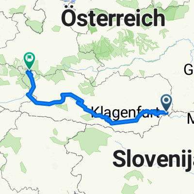
Beschreibung: Von Lavamünd den Radweg, abseits von B und L Straßen, entlang der Lavant bis Wolfsberg. Ab Wolfsberg, führt ein Radweg parallel der B70, bis kurz nach St. Gertraud. Für die nächsten 10 Kilometer bleibt nur die B 70. Ab Prebl ein Mix aus kommunalen Wegen und Radwegen bis Reichenfels. Die letzten 2 Kilometer auf einen guten Radweg bis zum Anschluss an den R26.
Bewertung: Der Abschnitt von Lavamünd bis Wolfsberg ist sehr gut gelungen! Der zweite Abschnitt bis St. Gertraud leider eine Notlösung, aber immerhin ein Versuch. Die Kilometer auf der B 70 sind Lebensgefährlich und für Kinder ungeeignet. Von Prebl bis Reichenfels unter Ausnützung von kommunalen Wegenetz und parallel zur B 78 verlaufenden Radwegen wieder durchschnitt. Die letzten 2 Kilometer wieder sehr schönes Radfahren abseits von Straßen in schöner Natur.
Beschilderung: Ja
GPS Daten stimmen mit der Beschilderung überein: Ja
- -:--
- Duration
- 58.4 km
- Distance
- 780 m
- Ascent
- 260 m
- Descent
- ---
- Avg. speed
- 874 m
- Avg. speed

Route quality
Waytypes & surfaces along the route
Waytypes
Cycleway
34.3 km
(59 %)
Busy road
10.6 km
(18 %)
Surfaces
Paved
27.2 km
(47 %)
Asphalt
26.4 km
(45 %)
Paved (undefined)
0.7 km
(1 %)
Continue with Bikemap
Use, edit, or download this cycling route
You would like to ride R10 Lavant Radweg or customize it for your own trip? Here is what you can do with this Bikemap route:
Free features
- Save this route as favorite or in collections
- Copy & plan your own version of this route
- Sync your route with Garmin or Wahoo
Premium features
Free trial for 3 days, or one-time payment. More about Bikemap Premium.
- Navigate this route on iOS & Android
- Export a GPX / KML file of this route
- Create your custom printout (try it for free)
- Download this route for offline navigation
Discover more Premium features.
Get Bikemap PremiumFrom our community
Other popular routes starting in Lavamünd
 Lavamuend - Maribor
- Distance
- 74 km
- Ascent
- 643 m
- Descent
- 743 m
- Location
- Lavamünd, Carinthia, Austria
 22a_Donauradweg_Lavamünd-Klagenfurt
- Distance
- 67.8 km
- Ascent
- 358 m
- Descent
- 274 m
- Location
- Lavamünd, Carinthia, Austria
 2021KR_2_Lavamünd - Judenburg
- Distance
- 84.3 km
- Ascent
- 705 m
- Descent
- 315 m
- Location
- Lavamünd, Carinthia, Austria
 Gravel Austria, Etappe Kärnten
- Distance
- 294.7 km
- Ascent
- 3,738 m
- Descent
- 1,613 m
- Location
- Lavamünd, Carinthia, Austria
 , Lavamünd nach , Frohnleiten
- Distance
- 127.7 km
- Ascent
- 2,073 m
- Descent
- 1,978 m
- Location
- Lavamünd, Carinthia, Austria
 Corona-Umfahrung Spielfeld
- Distance
- 84.9 km
- Ascent
- 1,267 m
- Descent
- 1,353 m
- Location
- Lavamünd, Carinthia, Austria
 VI-Lj11: Pfarrdorf - Ferlach, 70,7km 630hm
- Distance
- 70.7 km
- Ascent
- 798 m
- Descent
- 721 m
- Location
- Lavamünd, Carinthia, Austria
 Lavamund-Koralpe-Lamprechtsberg-Lavamund
- Distance
- 96.1 km
- Ascent
- 2,868 m
- Descent
- 2,866 m
- Location
- Lavamünd, Carinthia, Austria
Open it in the app