Zubergasse nach Löwengrube
- 906.7 km
- 6,101 m
- 6,477 m
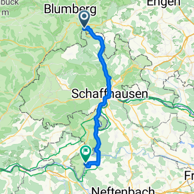
- Blumberg, Baden-Wurttemberg, Germany
A cycling route starting in Blumberg, Baden-Wurttemberg, Germany.
Overview
The Wutach Gorge adventure begins at the Wutachmühle sawmill. Here the valley becomes increasingly narrow and primeval in character. Towards the end, the path ascends to the stage destination at Schattenmühle at the exit of the Lotenbachklamm. / Current situation: Due to the narrow paths in the gorges, the required minimum distance of 1.50 m cannot be maintained when walkers meet. In any case, a mouth and nose mask should be carried. We recommend hiking the Schluchtensteig in the recommended direction from Stühlingen to Wehr to avoid oncoming traffic.
created this 3 years ago
Continue with Bikemap
You would like to ride Schluchtensteig Schwarzwald Etappe 2 von Blumberg zur Schattenmühle or customize it for your own trip? Here is what you can do with this Bikemap route:
Free trial for 3 days, or one-time payment. More about Bikemap Premium.
Discover more Premium features.
Get Bikemap PremiumFrom our community
Open it in the app