

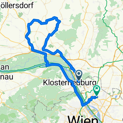
Höhenstraßen - Marathon (Wien) CLONED FROM ROUTE 53730
A cycling route starting in Langenzersdorf, Lower Austria, Austria.
Overview
About this route
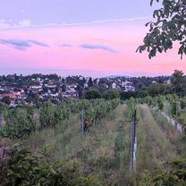
Connection of the well-known climbs in the NW... for mountain goats
- -:--
- Duration
- 95.6 km
- Distance
- 1,485 m
- Ascent
- 1,493 m
- Descent
- ---
- Avg. speed
- ---
- Max. altitude
Route quality
Waytypes & surfaces along the route
Waytypes
Road
47.8 km
(50 %)
Quiet road
10.5 km
(11 %)
Surfaces
Paved
72.7 km
(76 %)
Asphalt
72.7 km
(76 %)
Undefined
23 km
(24 %)
Continue with Bikemap
Use, edit, or download this cycling route
You would like to ride Höhenstraßen - Marathon (Wien) CLONED FROM ROUTE 53730 or customize it for your own trip? Here is what you can do with this Bikemap route:
Free features
- Save this route as favorite or in collections
- Copy & plan your own version of this route
- Split it into stages to create a multi-day tour
- Sync your route with Garmin or Wahoo
Premium features
Free trial for 3 days, or one-time payment. More about Bikemap Premium.
- Navigate this route on iOS & Android
- Export a GPX / KML file of this route
- Create your custom printout (try it for free)
- Download this route for offline navigation
Discover more Premium features.
Get Bikemap PremiumFrom our community
Other popular routes starting in Langenzersdorf
 Krapfenwaldgasse 65-73 nach Michaelerwaldweg
- Distance
- 8.4 km
- Ascent
- 191 m
- Descent
- 241 m
- Location
- Langenzersdorf, Lower Austria, Austria
 Kahlenbergdorf- + Babenbergerstrecke(?) CLONED FROM ROUTE 455394
- Distance
- 40.8 km
- Ascent
- 703 m
- Descent
- 700 m
- Location
- Langenzersdorf, Lower Austria, Austria
 Sierndorf - Streitdorf ....
- Distance
- 76.5 km
- Ascent
- 358 m
- Descent
- 364 m
- Location
- Langenzersdorf, Lower Austria, Austria
 2025-07-22_Wien - Hainburg
- Distance
- 74.8 km
- Ascent
- 354 m
- Descent
- 360 m
- Location
- Langenzersdorf, Lower Austria, Austria
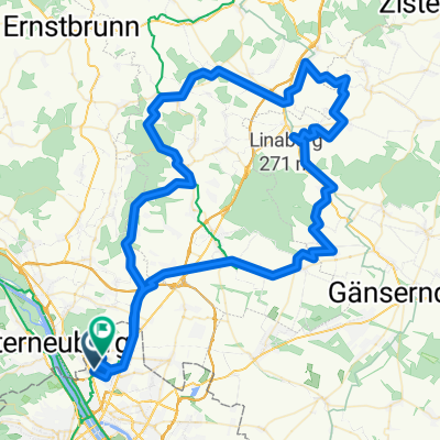 Route in Wien
- Distance
- 109.6 km
- Ascent
- 877 m
- Descent
- 878 m
- Location
- Langenzersdorf, Lower Austria, Austria
 Dopplerhütte
- Distance
- 52 km
- Ascent
- 612 m
- Descent
- 473 m
- Location
- Langenzersdorf, Lower Austria, Austria
 2. Heurigenschänken
- Distance
- 3.1 km
- Ascent
- 135 m
- Descent
- 51 m
- Location
- Langenzersdorf, Lower Austria, Austria
 Kreuttal IV (50km)
- Distance
- 49.9 km
- Ascent
- 439 m
- Descent
- 440 m
- Location
- Langenzersdorf, Lower Austria, Austria
Open it in the app