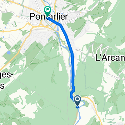
Etappe 15 Tour de France 2009 von Pontarlier nach Verbier
A cycling route starting in La Cluse-et-Mijoux, Bourgogne-Franche-Comté, France.
Overview
About this route
Tour de France 2009Etappe 15 vom 19.07.2009von Pontarlier nach Verbier
Hochgebirgsetappe mit 207,5 km Länge
zur 14. Etappe 2009 / zur 16. Etappe 2009 Le Tour / Etappe 15 - Das Original
Pässe und Steigungen zur Etappe: - Km 8.0 - Côte du Rafour 3.7 km zu 5.1 % - Km 18.5 - Col des Etroits 1.5 km zu 5 % - Km 54.0 - Côte de La Carrière 6.3 km zu 4.4 % - Km 74.0 - Côte de Prévonloup 4.5 km zu 4.7 % - Km 135.0 - Col des Mosses 13.8 km zu 4 % - Km 207.5 - VERBIER 8.8 km zu 7.5 %
- -:--
- Duration
- 207.8 km
- Distance
- 3,319 m
- Ascent
- 3,408 m
- Descent
- ---
- Avg. speed
- 1,442 m
- Avg. speed
Route quality
Waytypes & surfaces along the route
Waytypes
Busy road
155.1 km
(75 %)
Quiet road
22.2 km
(11 %)
Surfaces
Paved
133.4 km
(64 %)
Unpaved
2.1 km
(<1 %)
Asphalt
132.2 km
(64 %)
Ground
1.9 km
(<1 %)
Route highlights
Points of interest along the route
Point of interest after 6.5 km
Côte du Rafour (bei Km 8.0)<br /> 3.7 km Anstieg zu 5.1 % <br /> Kategorie 3
Point of interest after 19.3 km
Col des Etroits (bei Km 18.5)<br /> 1.5 km Anstieg zu 5 % <br /> Kategorie 3
Point of interest after 55.9 km
Côte de La Carrière (bei Km 54.0)<br /> 6.3 km Anstieg zu 4.4 % <br /> Kategorie 3
Photo after 57.1 km
Sprint
Point of interest after 75.1 km
Côte de Prévonloup (bei Km 74.0)<br /> 4.5 km Anstieg zu 4.7 % <br /> Kategorie 3
Point of interest after 101 km
Verpflegungszone
Point of interest after 134.3 km
Col des Mosses (bei Km 135.0)<br /> 13.8 km Anstieg zu 4 % <br /> Kategorie 2
Photo after 181.1 km
Sprint
Point of interest after 201.8 km
VERBIER (bei Km 207.5)<br /> 8.8 km Anstieg zu 7.5 % <br /> Kategorie 1
Continue with Bikemap
Use, edit, or download this cycling route
You would like to ride Etappe 15 Tour de France 2009 von Pontarlier nach Verbier or customize it for your own trip? Here is what you can do with this Bikemap route:
Free features
- Save this route as favorite or in collections
- Copy & plan your own version of this route
- Sync your route with Garmin or Wahoo
Premium features
Free trial for 3 days, or one-time payment. More about Bikemap Premium.
- Navigate this route on iOS & Android
- Export a GPX / KML file of this route
- Create your custom printout (try it for free)
- Download this route for offline navigation
Discover more Premium features.
Get Bikemap PremiumFrom our community
Other popular routes starting in La Cluse-et-Mijoux
- hgtfrtghjukyè§(t
- Distance
- 189.9 km
- Ascent
- 2,735 m
- Descent
- 3,011 m
- Location
- La Cluse-et-Mijoux, Bourgogne-Franche-Comté, France
- Grande Traversée du Jura, La Cluse-et-Mijoux à D 204, Montperreux
- Distance
- 24.5 km
- Ascent
- 567 m
- Descent
- 503 m
- Location
- La Cluse-et-Mijoux, Bourgogne-Franche-Comté, France
- De Rue de la Fauconnière 11, Oye-et-Pallet à Rue de la Fauconnière 1, Oye-et-Pallet
- Distance
- 8.5 km
- Ascent
- 63 m
- Descent
- 61 m
- Location
- La Cluse-et-Mijoux, Bourgogne-Franche-Comté, France
- dimanche 19 mai 2013
- Distance
- 56.7 km
- Ascent
- 287 m
- Descent
- 289 m
- Location
- La Cluse-et-Mijoux, Bourgogne-Franche-Comté, France
- Tour du Lac Saint-Point
- Distance
- 20.3 km
- Ascent
- 163 m
- Descent
- 159 m
- Location
- La Cluse-et-Mijoux, Bourgogne-Franche-Comté, France
- La Cluse-et-Mijoux - La Brévine - Lac des Brenets - Pontarlier
- Distance
- 95.8 km
- Ascent
- 1,140 m
- Descent
- 1,134 m
- Location
- La Cluse-et-Mijoux, Bourgogne-Franche-Comté, France
- 29 - Pontarlier - Sant du Doubs
- Distance
- 53 km
- Ascent
- 1,338 m
- Descent
- 1,353 m
- Location
- La Cluse-et-Mijoux, Bourgogne-Franche-Comté, France
- De Rue de la Fauconnière 11, Oye-et-Pallet à Rue du Barrage 14, Oye-et-Pallet
- Distance
- 20.7 km
- Ascent
- 226 m
- Descent
- 220 m
- Location
- La Cluse-et-Mijoux, Bourgogne-Franche-Comté, France
Open it in the app