

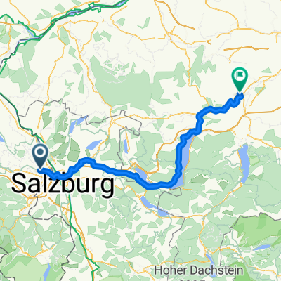
Salzkammergut-Radtour (Tag 1)
A cycling route starting in Freilassing, Bavaria, Germany.
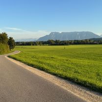
Overview
About this route
Steady climb from Salzburg
Steepest gradient at Nasenberg from Mondsee to St. Gilgen (Wolfgangsee)
- -:--
- Duration
- 67.5 km
- Distance
- 473 m
- Ascent
- 353 m
- Descent
- ---
- Avg. speed
- ---
- Max. altitude
Route quality
Waytypes & surfaces along the route
Waytypes
Cycleway
16.2 km
(24 %)
Quiet road
13.5 km
(20 %)
Surfaces
Paved
50.6 km
(75 %)
Unpaved
2.7 km
(4 %)
Asphalt
50 km
(74 %)
Gravel
2.7 km
(4 %)
Route highlights
Points of interest along the route
Point of interest after 35 km
Point of interest after 39.2 km
Point of interest after 44 km
Point of interest after 54.5 km
Point of interest after 67.5 km
Continue with Bikemap
Use, edit, or download this cycling route
You would like to ride Salzkammergut-Radtour (Tag 1) or customize it for your own trip? Here is what you can do with this Bikemap route:
Free features
- Save this route as favorite or in collections
- Copy & plan your own version of this route
- Sync your route with Garmin or Wahoo
Premium features
Free trial for 3 days, or one-time payment. More about Bikemap Premium.
- Navigate this route on iOS & Android
- Export a GPX / KML file of this route
- Create your custom printout (try it for free)
- Download this route for offline navigation
Discover more Premium features.
Get Bikemap PremiumFrom our community
Other popular routes starting in Freilassing
 Abendrunde Freilassing - Surheim
- Distance
- 21 km
- Ascent
- 128 m
- Descent
- 128 m
- Location
- Freilassing, Bavaria, Germany
 Waginger See 2
- Distance
- 65.8 km
- Ascent
- 621 m
- Descent
- 626 m
- Location
- Freilassing, Bavaria, Germany
 Salzkammergut-Radtour (Tag 1)
- Distance
- 67.5 km
- Ascent
- 473 m
- Descent
- 353 m
- Location
- Freilassing, Bavaria, Germany
 Freilassing Wasserburgerstr. nach Schwanenstadt
- Distance
- 111.9 km
- Ascent
- 729 m
- Descent
- 804 m
- Location
- Freilassing, Bavaria, Germany
 Ruhige Route
- Distance
- 30.1 km
- Ascent
- 323 m
- Descent
- 357 m
- Location
- Freilassing, Bavaria, Germany
 Schnelle Radrunde durch Freilassing
- Distance
- 5.9 km
- Ascent
- 4 m
- Descent
- 4 m
- Location
- Freilassing, Bavaria, Germany
 Freilassing - Hochstaufenrunde
- Distance
- 65.5 km
- Ascent
- 836 m
- Descent
- 836 m
- Location
- Freilassing, Bavaria, Germany
 rund um den Heuberg
- Distance
- 55.1 km
- Ascent
- 0 m
- Descent
- 0 m
- Location
- Freilassing, Bavaria, Germany
Open it in the app