

Schloss Holte - Externsteine-Tour
A cycling route starting in Oerlinghausen, North Rhine-Westphalia, Germany.
Overview
About this route
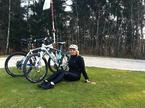
recht Flache Tour, ab und zu gehts mal steiler Berg auf, aber es ist ok.
An den Externsteinen ne kleine pause eingelgt und dann zurück geradelt =)
schöne Tour=)
- -:--
- Duration
- 69.4 km
- Distance
- 377 m
- Ascent
- 387 m
- Descent
- ---
- Avg. speed
- ---
- Max. altitude
Route quality
Waytypes & surfaces along the route
Waytypes
Quiet road
22.3 km
(32 %)
Busy road
15.1 km
(22 %)
Surfaces
Paved
50.2 km
(72 %)
Unpaved
8.9 km
(13 %)
Asphalt
46.3 km
(67 %)
Gravel
5.3 km
(8 %)
Continue with Bikemap
Use, edit, or download this cycling route
You would like to ride Schloss Holte - Externsteine-Tour or customize it for your own trip? Here is what you can do with this Bikemap route:
Free features
- Save this route as favorite or in collections
- Copy & plan your own version of this route
- Sync your route with Garmin or Wahoo
Premium features
Free trial for 3 days, or one-time payment. More about Bikemap Premium.
- Navigate this route on iOS & Android
- Export a GPX / KML file of this route
- Create your custom printout (try it for free)
- Download this route for offline navigation
Discover more Premium features.
Get Bikemap PremiumFrom our community
Other popular routes starting in Oerlinghausen
 Von Schloss Holte zur Sparrenburg (Hermannsweg)
- Distance
- 24.3 km
- Ascent
- 415 m
- Descent
- 373 m
- Location
- Oerlinghausen, North Rhine-Westphalia, Germany
 Rund um Leopoldshöhe von HaPe
- Distance
- 24.7 km
- Ascent
- 133 m
- Descent
- 139 m
- Location
- Oerlinghausen, North Rhine-Westphalia, Germany
 85 Vlotho-A2-B.Oe.-Löhne-HF
- Distance
- 85 km
- Ascent
- 281 m
- Descent
- 283 m
- Location
- Oerlinghausen, North Rhine-Westphalia, Germany
 Gartenweg 26, Schloß Holte-Stukenbrock nach Landerdamm 22, Schloß Holte-Stukenbrock
- Distance
- 51.3 km
- Ascent
- 465 m
- Descent
- 466 m
- Location
- Oerlinghausen, North Rhine-Westphalia, Germany
 Oerlinghausen-Hermannsdenkmal
- Distance
- 34.5 km
- Ascent
- 674 m
- Descent
- 674 m
- Location
- Oerlinghausen, North Rhine-Westphalia, Germany
 Über Wiedenbrück-Delbrück-Sennelager-Kreuzkrug-Augustdorf
- Distance
- 114.9 km
- Ascent
- 215 m
- Descent
- 215 m
- Location
- Oerlinghausen, North Rhine-Westphalia, Germany
 Fahrt durchs Ochsengehege
- Distance
- 16.5 km
- Ascent
- 403 m
- Descent
- 403 m
- Location
- Oerlinghausen, North Rhine-Westphalia, Germany
 Leopoldshöhe>Steinhorster Becken
- Distance
- 72.6 km
- Ascent
- 275 m
- Descent
- 254 m
- Location
- Oerlinghausen, North Rhine-Westphalia, Germany
Open it in the app