Venta La Romera
- 47.7 km
- 247 m
- 250 m
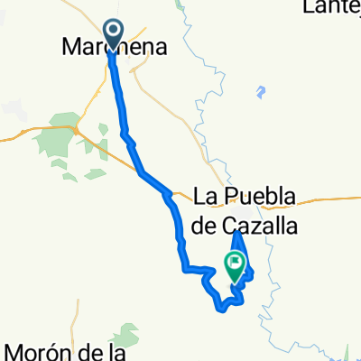
- Marchena, Andalusia, Spain
A cycling route starting in Marchena, Andalusia, Spain.
Overview
Route that takes a stretch of the Via Verde towards Córdoba and diverts to the Marchena-Fuentes de Andalucía road, passing through farms, bridges, and showcasing perspectives of the different crops in the area with color changes depending on the season.
created this 17 years ago
Route quality
Track
8.6 km
47 %
Road
6.9 km
38 %
Unpaved
4.7 km
(26 %)
Gravel
4.7 km
26 %
Undefined
13.5 km
74 %
Route highlights
Antiguo puente de piedra de la via del tren
Embalse de agua impresionante cuando está lleno. Un pequeño mar en la campiña de secano. Ojo, hay que bajarse de la bici y subir unos metros para poder verlo.
Este tramo tan recto y largo, es un camino preparado como pista de aterrizaje de aviones fumigadores.
Merendero del Rio Corbones
Continue with Bikemap
You would like to ride Ruta de la Via verde/Pista de aterrizaje or customize it for your own trip? Here is what you can do with this Bikemap route:
Free trial for 3 days, or one-time payment. More about Bikemap Premium.
Discover more Premium features.
Get Bikemap PremiumFrom our community
Open it in the app